A stark increase in atmospheric water vapor places some areas in danger.
The idea of a natural disaster striking where you live is nothing short of a nightmare, but it’s also becoming a growing issue in places that might not have been accustomed to it before. As the effects of climate change become clearer, the likelihood of a catastrophic event such as an intense hurricane or wildfire is becoming greater—as is the risk of devastating flooding.
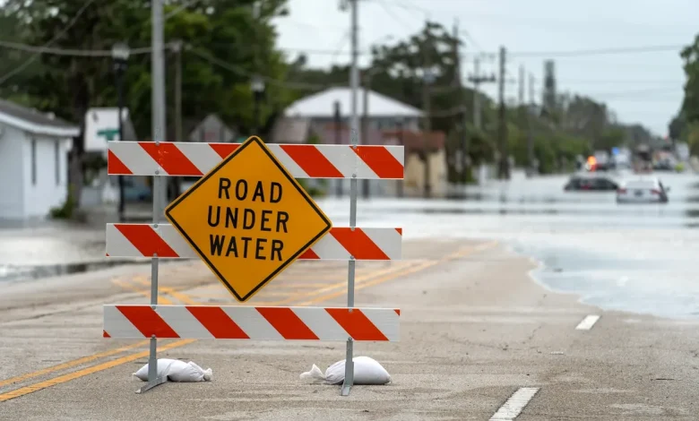
Recently, intense rainfall brought on by the “atmospheric river” has inundated the West Coast and caused serious devastation. But now, new data shows that such changing conditions have put some regions of the U.S. at risk of “deadly flooding.”
RELATED: 3 Regions Where Winter Will Arrive Earlier Than Usual This Year.
The latest findings come from an analysis conducted by The Washington Post, which looked at global climate data from recent decades. Their experts looked specifically at a metric known as integrated vapor transport (IVT)—or the amount of water vapor moving through the air—that can bring very heavy rains that lead to “unprecedented floods” in areas where levels are high.
The research found that overall, there has been a drastic global increase in IVT over the past 85 years, with an overall increase of 12 percent over that period. So far, this has already had some noticeable effects, including more devastating monsoons hitting Southeast Asia and deadly floods that devastated places like Valencia, Spain, and the Texas Hill Country last year.
“We need a new appreciation of the power of water,” Ed Clark, a temporarily retired hydrologist and director of the National Oceanic and Atmospheric Administration’s National Water Center, told The Post. “As we’re seeing our world warm and water vapor in the atmosphere increase…it activates something that doesn’t look like anything most humans have seen before.”
As increasing global temperatures affect weather, experts said that the findings made by The Post can help provide insight and help predict which areas could experience “precipitation extremes” in the coming years. Here’s which parts of the U.S. could see the worst flooding, based on which places have seen their IVT increase the most over the past three decades.
RELATED: The #1 Sign Your Region Is About to Get Its First Hard Freeze.
1. The Southeast
While this area is no stranger to devastating hurricanes, data suggests that rain events could become even worse. Places like North Carolina have seen a 4.8 percent increase in moisture flows since 1992 across about 65 percent of the state (above the global average increase rate of 3.6 percent); South Carolina has seen a 5.8 percent increase over 86 percent of its territory; Georgia has seen a 4.1 percent increase over 64 percent of its land; and Florida has seen a 5 percent increase over 68 percent of the state. Notably, Virginia has also seen a 5.3 percent increase across its entire territory.
And it’s not just the East Coast that’s at risk. Louisiana’s stark increase (4.2 percent) covers 63 percent of the state; Arkansas has recorded a 4.6 percent increase in IVT since 1992, affecting 88 percent of its land area; and Tennessee has seen a 4.2 percent increase across 88 percent of its territory.
2. Alaska
Few places in the U.S. feel the effects of climate change quite like Alaska. Experts say increased moisture flows are rising temperatures in the Arctic and bringing more severe storms in from the Pacific to higher latitudes than previously seen, The Post reports.
According to data, 43 percent of the largest state in the union is now considered a potential new flooding hotspot. There, the IVT has risen 7 percent since 1992—which is more than twice the global average.
RELATED: 34 States That Will Have Unusually Hot Falls This Year.
3. New England and the Northeast
While much of the Eastern Seaboard has seen a dramatic increase in IVT, few have seen such a uniform rise as the topmost corner of the Northeast. New England’s entire land area across seven states is affected, with Vermont jumping 5.8 percent; New Hampshire rising 6.1 percent; Maine increasing 7 percent; Massachusetts rising 6.1 percent; Rhode Island increasing 6.1 percent; and Connecticut rising by 5.6 percent, per The Post.
Still, other states in the area have seen considerable jumps. A 4.2 percent IVT increase in New York affects roughly two-thirds of the state’s land area; all of New Jersey is now considered a flooding hotspot with a 6.4 percent increase; and the entirety of Delaware is at risk with a 5.5 percent rise in IVT over the past three decades.
4. The Southwest and Rockies
Entire portions of the American West could also be affected by these precipitation changes, especially around the Rockies. Colorado has seen a 4.2 percent increase affecting 29 percent of its land area; New Mexico has seen a 4.5 percent increase over about half its territory; and Nevada has seen a 4.4 percent increase, affecting 9 percent of its land area along its western border with California.