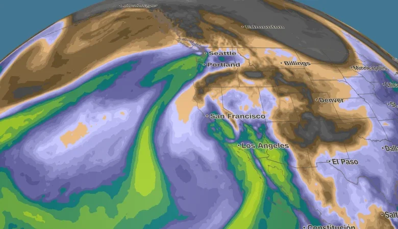
A strong Pacific storm is pushing into Southern California and ingredients are in place for potential life-threatening flooding, mudslides and debris flows, especially near burn scars in the Los Angeles area.
The storm system moved through northern and central California on Thursday with a mix of strong winds and heavy rain. Widespread rainfall totals of 1 to 2 inches were observed along the coast over the past 24 hours, with isolated amounts of 3 to 5 inches in the coastal mountain ranges.
San Francisco received nearly an inch and a half of rain Thursday, nearly 75% of November’s average. November marks a transition into the rainier winter season, with December to February marking the wettest months of the year in the Bay Area.
Winds in the higher elevations have gusted 60 to 80 mph Thursday with San Francisco gusts topping 50 mph.
The winds will ease as the system drops into Southern California, but the flood threat will intensify as an atmospheric river feeds moisture from the ocean into the storm.
An initial wave of heavy rain, impacting the region Friday morning, is expected to ease Friday afternoon. A second, more intense wave will move in Friday night into Saturday, with prolonged heavy rain possible. Rainfall rates could be as high as an inch per hour at times.
Much of the Los Angeles area is under a flood watch through 10 p.m. Saturday. The National Weather Service warns that the storm could trigger life-threatening debris flows, knock out power and flood roads.
Burn scar areas from recent wildfires in the region will be particularly vulnerable to mudslides and debris flows. Not only do wildfires destroy vegetation that would normally soak up some of the rainfall, but their extreme heat can alter the soil, creating a water-repellent layer just below the surface.
Officials have warned residents near the recent Palisades, Hurst and Sunset fires’ burn scars to be prepared to evacuate.
“Residents, especially those in vulnerable areas, should start taking precautions immediately to prepare for the storm and protect their interests,” the National Weather Service in Los Angeles said. “This scenario would potentially create many significant impacts area-wide, including possible debris flows in the burn areas, significant ponding of roads and highways, mudslides through the canyons, fallen trees, etc.”
Residents can pick up sandbags at Fire Stations throughout the City, with sand also available for free at select locations.
The heaviest rain should ease late Saturday, but the region isn’t in the clear right away. Showers linger into Sunday, and the ground will be saturated. It won’t take much rain to trigger more minor flooding or keep roads slick, especially in spots that usually drain slowly after big storms.