Southern California storm forecast worsens as flood watch is issued: Here’s what to expect
Don’t put away those umbrellas just yet: Possibly intense rain from Southern California’s latest storm could last through Friday before the region gets a Thanksgiving break from precipitation.
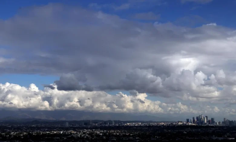
Forecasters on Thursday afternoon issued a flood watch — warning of possible flooding — from 10 p.m. Thursday through Friday morning throughout much of Los Angeles County. The storm still has a chance of producing precipitation into the early part of the weekend.
A flash flood watch was also set to take effect at midnight Friday through that evening in eastern Riverside County and Imperial County.
The latest models suggest a “severe weather threat across L.A. County,” the National Weather Service said. The storm could rotate in a counterclockwise direction right over southern L.A. County on Thursday night and Friday morning, which could even produce a small tornado.
“Periods of heavy rain are likely at times overnight in L.A. County,” with some computer models showing a 10-20% chance of rain falling at 1 inch per hour. Not all areas will get such intense rainfall, but areas that do get hit by that kind of intense rain could see flooding.
Rain falling at a rate of half an inch per hour or more is capable of producing landslides.
There is also a 10-20% chance of thunderstorms in Los Angeles and Ventura counties through Friday morning, and a 20-40% chance in Orange County, San Diego County and the Inland Empire.
Those thunderstorms could bring “isolated heavy downpours and wind gusts up to 50 mph,” the weather service office in Oxnard said, and carry a remote risk for a tornado.
There is some uncertainty about the rain and snow on Friday and Saturday. Typically, Southern California’s weather systems move from the west to the east, and that’s expected for Thursday night into Friday morning.
“We could actually see winds turn out of the south, and maybe out of the east,” said Dave Munyan, a meteorologist with the weather service office in San Diego, and “we could see precipitation moving northward and even westward back from the deserts into some of the mountain areas come Friday afternoon into Saturday.”
But raising the uncertainty on Friday and Saturday is that the storm is being powered by a “cut-off low,” in which low pressure is cut off from the jet stream — making the storm system harder to predict.
“The unusual evolution of this storm will reverse the typical distribution of the rain, with the higher totals and rates to the south compared to the north,” according to the weather service office in Oxnard. Forecasters do expect gusty winds from the east on Friday, which could cause delays at Los Angeles International Airport.
The recent spate of precipitation has defied early expectations of a dry start to the water year, which began on Oct. 1. Santa Barbara Airport has already recorded its wettest November since records started being kept there in 1941, accumulating 8.42 inches so far this month. Prior to this month, the wettest November for the airport was recorded in 1965, when 6.92 inches fell, said Lisa Phillips, meteorologist with the National Weather Service office in Oxnard.
That places this November just outside the 20 wettest calendar months ever recorded at the airport, said meteorologist John Dumas of the weather service’s Oxnard office.
In downtown Los Angeles, 3.48 inches of rain has fallen in November alone — nearly 10 times the average for this point in the month. That’s the wettest November for downtown L.A. in more than 40 years, trailing 1982, when 4.41 inches of rain fell.
The wettest November on record for downtown L.A. occurred in 1965, when 9.68 inches fell.
Since the start of the water year on Oct. 1, 4.89 inches of rain has fallen in downtown L.A. — five times more than the average for this time of year, and one-third of the average annual rainfall. Last year at this time, only 0.07 of an inch had fallen since the start of the water year. For the region, it was a record-dry start to the water year that set the table for one of the most destructive wildfire seasons in Southern California history.
At John Wayne Airport in Orange County, 3.89 inches of rain has fallen since Oct. 1, quadruple the average for this point in the season. San Diego International Airport has seen 2.93 inches, triple its usual average.
Forecasters have said that it takes 3 to 4 inches of rain in the lower elevations to effectively end high fire season in Southern California, and experts say the region is definitely in better shape to resist fire-whipping Santa Ana winds this autumn.
“This is definitely taking a big bite out of what could be this fire season,” Munyan said. “If we continue to get good rainfall through December, then, yeah, we could very well not have much of a fire season this year for SoCal.”
Through Saturday, Anaheim, Irvine and Oceanside were expected to get 1 to 1.5 inches of rain; with 0.7 of an inch to 1 inch in San Diego, San Bernardino, Ontario, San Clemente, Oceanside and Palm Springs ; and 0.5 of an inch to 1 inch in Riverside. Joshua Tree National Park could get 1.5 to 2 inches of rain.
Showers could persist all the way into Saturday morning in L.A. County, but the rest of the weekend “is expected to be dry but cool,” the weather service said. The rest of the Thanksgiving week is expected to be dry, and temperatures will warm up, with highs in many areas in the mid-60s to low 70s, the weather service said.
This latest storm is not expected to bring snow to the Grapevine section of the 5 Freeway, which reaches an elevation of 4,144 feet at the Tejon Pass.