Ontario is bracing for a blast of winter weather this week, with forecasters warning of significant snowfall across the north and lake‑effect squalls set to hammer southern regions as November draws to a close.
What to expect in southern Ontario. Will the GTA escape the snow?
While the system’s core will remain to the north, southern Ontario won’t escape its reach.
By Thursday, a release of Arctic air will funnel across the Great Lakes Basin, dropping temperatures and fueling strong winds of 60–80 km/h. Those gusts are expected to push lake‑effect snow squalls into the snowbelts downwind of Lake Huron and Georgian Bay, with forecasters warning that even the Greater Toronto Area (GTA) could see bursts of heavy snow.
Future weather forecast for GTA and Ontario, Fri. Nov. 28, 2025
Graphic: CITYNEWS
Travel through the snowbelt regions on Thursday and Friday could be treacherous, with whiteout conditions likely during squall activity.
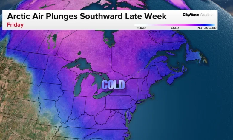
Snow squalls return starting Thursday
Graphic: CITYNEWS
Toronto’s forecast points to mid-week rain followed by a sharp drop in temperatures. This is because the polar vortex is beginning to wobble. Think of the polar vortex as a wall of strong winds that keep the cold air near the poles. It is located above both poles around 15-48 km above the ground and is nothing new. But when something happens to disrupt this “wind wall,” cold air sinks southward.
Polar vortex with a strong jet stream explained
Graphic: CITYNEWS
Polar vortex with a weak jet stream explained
Graphic: CITYNEWS
Good old-fashioned winter weather depends on a weak or disrupted polar vortex. In this case, the disruption will mainly be due to something called an “SSW” or “sudden stratospheric warming” which will weaken the “wind wall”. While spills of cold air at this time of year are not unusual, the “SSW” event that will cause it is early for this time of year, happening only a couple of times this early in the season in the past 70 years.
The current La Niña is also playing a role in this shift to cold weather. The CityNews winter outlook released earlier this month maintains that the first half of winter will be cold across the Great Lakes, while the second half in early 2026 looks to be milder.
Early winter forecast in Ontario, Nov 2025 – Jan 2026
Graphic: CITYNEWS
Late winter forecast in Ontario, Jan – Mar 2026
Graphic: CITYNEWS
Toronto’s short-range forecast
Monday will be mainly sunny, with a high near 9°C, and temperatures will fall to 4°C tonight.
On Tuesday, the day will be cloudy with showers beginning near the noon hour, reaching a high of 9°C. Rain is likely overnight with a low of 7°C.
Wednesday will remain cloudy with on and off showers through the day switching to rain/snow mix by the evening. The high of 11°C will begin falling during the afternoon as strong winds pick up. Overnight, there is a 40 per cent chance of flurries or rain showers, with temperatures falling to 0°C and gusty winds continuing.
Thursday will be cloudy with blowing snow at times for the city. It will also be windy, with a daytime high of 1°C. Heavy flurries are expected overnight, with a low of –2°C and a morning wind chill near –10 by Saturday morning.
What will areas north of the GTA see?
A developing low‑pressure system south of Lake Superior late Tuesday is expected to merge with an Alberta clipper triggering widespread snow through Thursday, creating hazardous travel conditions across northern Ontario. Environment Canada has issued winter storm watches for dozens of communities, including Thunder Bay, Timmins, Kapuskasing, Marathon and Wawa.
Weather watches and warnings, Ontario, Nov 2025
Graphic: CITYNEWS
“Strong northerly winds will also accompany the snow, leading to possible blowing snow that could reduce visibility to near zero at times,” writes Environment Canada on Monday. “There remains uncertainty with the exact track of the low-pressure system, and therefore the corridor of heaviest snowfall. Total snowfall amounts may exceed 30 cm for some locations north of Lake Superior.”
Drivers are being urged to prepare for poor visibility, slick roads, and possible closures.
Click here to sign up for the CityNews Weather Guarantee and to check out Toronto’s extended forecast.