PHOENIX (AZFamily) — The West Valley got hit hard with heavy rain and what looked like snow, but was actually hail, on Wednesday and more storms are on the way.
We have extended the First Alert Weather Day through Thursday for a couple of reasons.
The flood watch, which includes portions of the north Valley like Scottsdale, Deer Valley neighborhood, Cave Creek and more, has been extended until 6 a.m. In addition, overnight rain chances have also increased to 45% to 70% through the early morning hours.
Rain chances have increased in the Valley.(Arizona’s Family)
That means Valley workers could see a wet commute on Thursday morning.
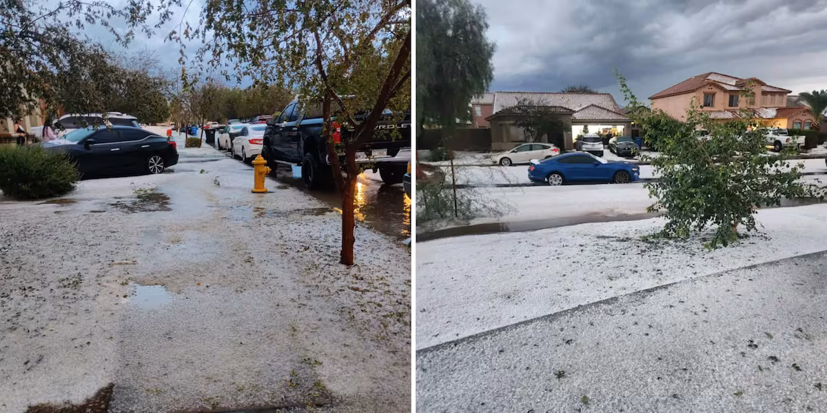
West Valley sees brunt of storms
A string of thunderstorms moved from the southwest, going from the Avondale and Tolleson areas to Glendale and Peoria on Wednesday afternoon.
Several viewers recorded video of heavy rain and hail that covered the streets. The severe weather caused the partial roof collapse of Desert Sky Mall in west Phoenix. Dozens were evacuated.
Avondale got hit with rain while hail covered the streets near 100th Avenue and Lower Buckeye Road.(Kelly Nicole Thurman/Miguel Roman)
The wet weather also caused some delays at Phoenix Sky Harbor Airport. The FAA reportedly issued a ground stop for flights heading to the Valley but it was canceled just before 6 p.m. Some flights departing from Phoenix were experiencing delays of up to an hour or more.
At the height of the storm, more than 6,600 SRP customers didn’t have electricity, mostly in Glendale and west Phoenix. Less than 450 APS customers were without power at the same time. Fewer than 800 customers from both companies don’t have power as of 9 p.m.
Because of Tuesday’s rain, the ground is saturated, and any additional rainfall could lead to flooding.
Temperatures will stay in the mid-60s for the next few days, until the 70s return next week with drier conditions.
In the Valley, look for rain that began this morning to continue throughout today and tonight. Gibby takes a look at road conditions for the morning commute.
Thursday afternoon should be dry in the Valley.
For the High Country, snow levels will drop to around 6500 feet through Thursday, with another 1-2″ possible for areas like Flagstaff. Heavier accumulations are possible in eastern Arizona from the Rim to the White Mountains as the system shifts east overnight.
One to four inches of rain above 7,000 feet is possible through Thursday. Then, another system moves into the state right on the heels of this storm. Another Pacific weather system will move eastward toward our region Thursday night, bringing more moisture into the state and increasing rain chances in western Arizona early Friday morning.
Right now, rain chances are around 30% for the Valley on Saturday and Sunday. Rainfall amounts are still uncertain. By next week, expect quieter conditions and highs back in the 70s.
See a spelling or grammatical error in our story? Please click here to report it.
Do you have a photo or video of a breaking news story? Send it to us here with a brief description.
Copyright 2025 KTVK/KPHO. All rights reserved.