First winter storm of 2025 could produce blizzard conditions, drop 2 feet of snow in Wisconsin
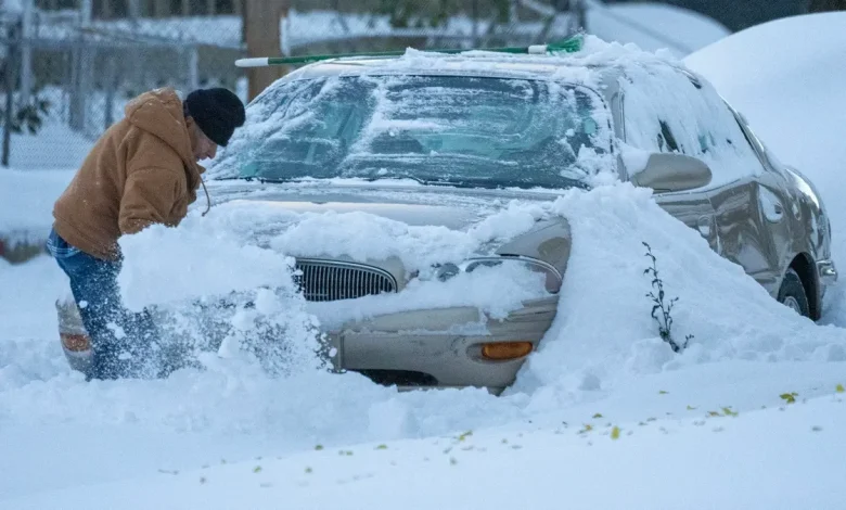
How snow is cleared at Mitchell International Airport
How snow is cleared at Mitchell International Airport
Mike De Sisti, Milwaukee Journal Sentinel
The first major winter storm of the year is forecast to hit northern Wisconsin on Tuesday, Nov. 25, dropping as much as 30 inches of snow in some parts of the state.
As of 3 p.m. Tuesday, the National Weather Service office in Duluth, Minnesota, has issued winter storm warnings across most of northern Wisconsin, including Vilas, St. Croix, Rusk, Barron, Price, Burnett, Sawyer, Washburn, Oneida, Forest and Florence counties. The northernmost areas — Bayfield, Ashland, Iron and Douglas counties — are under a blizzard warning.
The warnings begin at 6 p.m. Tuesday, Nov. 25 and extend as late as 6 a.m. Thursday, Nov. 27 in some areas. You can find the full list of warnings and advisories here.
Though northwest Wisconsin will get the bulk of snow, the NWS has also issued winter weather advisories as far south as La Crosse and Sheboygan. Areas with winter weather advisories may see between two to five inches of snow, as well as gusty winds, according to NWS meteorologist Ketzel Levens.
Potential snow accumulation varies, with warm water temperatures in Lake Superior likely to lead to some heavy lake-effect snow in several counties, Levens said. Douglas and Bayfield counties are expected to see up to 18 inches of snow, while Ashland and Iron counties and northwestern Vilas County may see up to 24 to 30 inches.
Along with Ironwood, Michigan, the city of Hurley — known as the snowiest place in Wisconsin — will be the “bulls-eye” of the event, Levens said. Snowfall in these two cities on the Wisconsin-Michigan border could exceed 30 inches.
Travel could be very difficult, NWS warns, with winds up to 45 mph and blowing and drifting snow. Gusty winds could bring down tree branches and isolated power outages are possible.
The Tuesday morning and evening rush hour commutes “shouldn’t be too bad,” but anyone traveling later Tuesday evening or on Wednesday should be ready for snow, Levens said. In areas with blizzard warnings, travel may be “near impossible” during the storm, she said.
“If you’re driving north between 6 p.m. and midnight Tuesday, that’s when we’ll see that rain start turning into snow,” Levens said. “By the time we get to Wednesday, everything should be snow.”
Visibility on the road may drop to a quarter of a mile, NWS says. Hunters in the northwoods should be prepared for very difficult travel conditions on Tuesday and Wednesday evening, the warning said.
Here’s what else to know about the warning:
See the Wisconsin weather radar
What to do in a winter storm
During a winter storm, NWS advises staying inside, stocking up on food and water, and charging essential devices in case of power outages.
If you are without shelter, you can visit the 211 Wisconsin website or call 211 to locate nearby warming services.
Wisconsin road conditions
NWS advises against driving during a storm, as snow, sleet or ice can create dangerous driving conditions. For live updates on winter road conditions and accidents in Wisconsin, check out the 511 Wisconsin map .
If you must drive, here are some guidelines for navigating icy roads, according to the Wisconsin Department of Transportation:
- Keep safe distances between snow plows and large trucks. Stay at least 200 feet behind any working plow to make sure your visibility isn’t obscured. Also keep a safe distance behind trucks on the highway, since pieces of snow or ice can fly off the top of commercial vehicles driving fast.
- Clear snow and ice from your vehicle’s windows, roof, hood and front and rear lights. You can do this by warming up the car and then using a snow brush and ice scraper to clear the snow and ice.
- Drive slowly, allowing extra travel time and leaving extra distance between vehicles.
- Turn on your low-beam headlights. State law requires drivers to turn on their vehicle’s low-beam headlights any time weather or other conditions make it difficult to see objects 500 feet ahead, WisDOT says.
- Use brakes early and carefully. With anti-lock-brakes, use firm, steady pressure and gently steer. Never use cruise control in winter weather.
- Watch out for bridge decks and overpasses. These areas can be especially slippery when the roads ice over.
What is a winter storm warning?
A winter storm warning is more severe than a watch or advisory. Here are what the different alerts mean, according to NWS:
- A Winter Storm Warning means snow, sleet or ice is expected, so take action.
- A Winter Storm Watch means those conditions are possible, so be prepared.
- A Winter Weather Advisory means wintery weather is expected, so be careful.
This weather report was generated automatically using information from the National Weather Service and a story written and reviewed by an editor. It was updated to add new information and correct an inaccuracy.
See the latest weather alerts and forecasts here