Time’s reputation for distorting the past is well established and equally deserved. It’s so good at what it does that at some point in every person’s life they begin to doubt – to some degree at least – the validity of their own memories.
I bring this up because in my surely flawed mind, 90 percent of the games Louisville played against Cincinnati in the 1990s took place on Thursday nights at 9 p.m. on ESPN. Both teams always had legitimate national title aspirations, and every game between the pair rivaled Game 5 of the 1976 NBA Finals.
Most people experience several drastic life changes in their 20s, 30s or 40s, but there’s a sense of familiarity inherent in established adulthood that makes all the rearranging feel like it’s still part of the same “era,” for lack of a better term. The same can’t be said for youth, where the period from ages 6-13 essentially encompasses three or four different lives. It’s likely this phenomenon that has made late Thursday night games against Cincinnati feel like more of a staple of Cardinal basketball in the ‘90s than they may have been for other generations.
Still, the memories feel fresh to me.
This was a period where Cincinnati was consistently one of the best team in college basketball, and almost always the baddest. The rivalry between the Cardinals and Bearcats defined Conference USA basketball, and it always demanded a national audience.
In the days leading up to the games against UC, my friends and I would update each other on the status of our persuasive attempts to earn permission to attend the game or at least stay up and watch it. Some would celebrate an unparalleled triumph of youth, while others would shed tears and be relegated to an early morning update from their father or The Courier-Journal.
The one memory I have that stands out above all others from this period was basking in the glow of the 1996 victory in the old living room at my parents’ house and realizing that “The Late Show With David Letterman” was on. Letterman viewings at this point in my life were typically reserved for the summer time, when my brother, Oliver, more than 10 years my elder, was home from college. Oliver was cool, Dave was cool, and staying up with him until midnight as an 11-year-old was definitely cool.
Watching Letterman give gag orders while going through drive-thru lines was a privilege reserved for July, when life’s only responsibility was, at its most demanding, a Little League game the next evening. A Thursday night in the dead of winter? This was special.
The Cards just beat Cincinnati, Letterman’s on, I’ve got school tomorrow and holy mother of God I’m still awake!
It may have been the most celestial moment of my childhood.
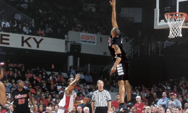
The rivalry with Cincinnati was never on par with Kentucky (nothing is), but it certainly had its own place. While disdain for the wild brand of cats is an almost inherent aspect of being a Louisville fan, the Bearcats had to earn their ire. The players were dirty and didn’t care (Kenyon Martin is still the most intimidating human being I’ve ever been in the presence of), Bob Huggins’ antics made him perhaps the ultimate U of L villain of the ‘90s, and more times than not they got the better of our beloved Cardinals. All of these factors made the pair of annual games two of the biggest events during winters in Louisville, and made the victories incredibly special.
And then, because of conference shakeups having more to do with football than basketball, the rivalry followed the same pitiless path that youth itself always takes: it changed dramatically overnight, and then it disappeared forever.
Louisville and Cincinnati made the move to the Big East together in 2005. Just two months before the start of their first basketball season together in the conference, Huggins was forced to resign after a power struggle with UC’s president. The rivalry never really recovered.
After nearly a decade together in the Big East and one season as compatriots in The American, the longstanding relationship between the Cards and the “other” Cats ended for good when U of L bolted for the ACC and UC got left behind.
The two programs met for the 100th time three years ago (and the first time since their conference breakup) in what might have been the most forgettable of all 100 matchups: A 7th place game at the Maui Invitational in front of approximately 35 fans. Cincinnati won by 19 and dropped Kenny Payne’s first Cardinal team to 0-6 on the season, the worst start in program history.
A new chapter begins on Friday night.
In the first game of a two-year series, Louisville and Cincinnati will square off inside Heritage Bank Center in downtown Cincy. Both teams are 4-0, and both teams are looking to recapture some escaped magic. Part of that is rediscovering one another.
“Adding a neutral-site game against Cincinnati was just another great piece in our scheduling puzzle,” said Louisville head coach and Cincinnati native Pat Kelsey when the series was announced. “There is great history between our two programs as we were rivals for many years. I sense the fan bases on both sides are excited. I grew up going to the Riverfront Coliseum which is now Heritage Bank Center. In fact, it was the first place that I saw Coach Crum’s Louisville Cardinals play live – I’m excited to coach the 2025-26 edition of the Cards in the same venue.”
Letterman’s off the air now. Louisville plays in the ACC and Cincinnati in the Big 12. Both programs have fallen on hard times but appear to be on the way back up … although one, per usual, appears to be closer to that ceiling than the other.
Time has moved on, but the thoughts of Danny Fortson, Bobby Brannen’s barb-wired tattoo, Freedom Hall, Denny Crum, Bob Huggins, childhood in Louisville and magical Thursday night celebrations that lasted beyond 11:30 haven’t gone anywhere. It feels good to have this, and so many other things, back.
Go Louisville. Beat Cincy.