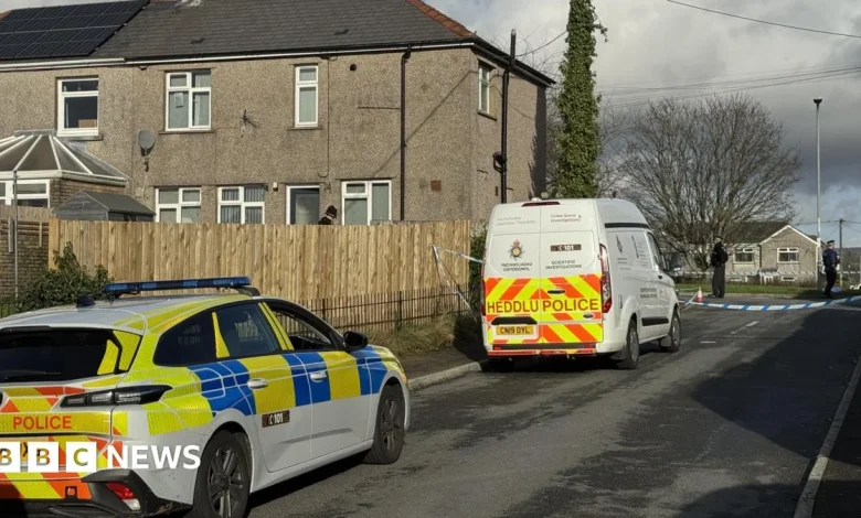
Trends-IE

Met Eireann issues snow update as Scotland sees first flakes of winter

Winter is coming and Ireland is starting to feel the first effects as temperatures continue to drop.

The October bank holiday weekend is facing the start of some quite cold nights with overnight lows falling to around 1C in some areas.

Meanwhile, daytime temperatures are expected to struggle to reach double digits.

Winter is coming and Ireland is starting to feel the first effects as temperatures continue to drop. Pic: Eamonn Farrell / © RollingNews.ie

A biting windchill will also make the air feel even colder and with the clocks turned back, there is a sense of winter among us.

Scotland has already seen its first snowfall of the season on high ground overnight.

However, despite Ireland’s chilly spell, Met Eireann insists that it’s unlikely that snow will reach the country during this cold snap.

Stormy weather could arrive later in the week. Pic: Stephen Collins/Collins Photos

While snow might not be on the cards right now, the national forecaster has issued an ominous warning, predicting unsettled conditions over the coming days.

Met Eireann has forecast widespread showers, moderate winds and the chance of hail, alongside consistently chilly temperatures that are expected to continue into early next week.

The meteorological agency is also monitoring a system that could bring stormy weather later next week.

Met Eireann has forecast wet conditions for much of the week. Pic: Rollingnews.ie

They said: ‘There is uncertainty in the forecast for the end of the working week but current indications suggest that it will turn more unsettled with a spell of wet and blustery weather possible later on Thursday and Friday.’

Over the coming days, Ireland can expect a continuation of this cold, unsettled pattern.

Daytime highs will remain low, showers are likely to pop up across the country and coastal areas will see stronger gusts as winds pick up.

For the next few days, Met Eireann continued: ‘Dull, damp and breezy Sunday morning as outbreaks of rain and drizzle spread from the west.

‘During the late afternoon and evening, rain will become confined to Munster and south Leinster with bright spells and isolated showers developing elsewhere.

‘Light to moderate westerly winds will increase moderate to fresh through the morning. Highest temperatures of 10C to 13C.

‘A dry start bank holiday Monday for many with sunny spells. However, patchy rain and drizzle in the west and southwest will spread northeastwards across the country through the morning and afternoon.

‘Highest temperatures of 11C to 15C in moderate westerly winds, freshening on Atlantic coasts through the day.

‘A breezy but bright and mostly dry day Tuesday with scattered showers and spells of sunshine. Highest temperatures of 11C to 14C in moderate to fresh west to southwest winds.

‘Showers will become more scattered early on Wednesday to leave plenty of dry weather and spells of sunshine. Highest temperatures of 8C to 12C in moderate to fresh westerly winds.’

Related Articles

Leave a Reply

Your email address will not be published. Required fields are marked *

Back to top button