N.J. weather: Gusts up to 60 mph could blast parts of state, sparking wind alerts in 10 counties
New Jersey will be calm and quiet Tuesday night, but a strong cold front moving across the region on Wednesday is expected to generate powerful wind gusts.
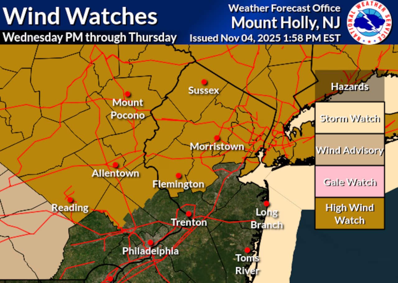
Forecasters say some of the gusts could get as high as 50 to 60 mph, prompting the National Weather Service to issue high wind watches for 10 counties.
The watches, effective from Wednesday evening through Thursday morning, cover the counties of Bergen, Essex, Hudson, Hunterdon, Morris, Passaic, Somerset, Sussex, Union and Warren counties.
The approaching frontal system will bring southwest winds increasing throughout Wednesday, with gusts reaching 20 to 30 mph by late afternoon.
Following the passage of the cold front Wednesday evening, much stronger northwest winds are expected to develop, with potential gusts of 45 to 60 mph in northern New Jersey counties, according to the weather service.
The strongest winds will occur over a six- to nine-hour period beginning Wednesday night and should start diminishing by Thursday morning.
Even areas south of the watch, including those near the Interstate 95 corridor, could experience strong gusts of 45 to 55 mph. The National Weather Service warns that these winds could potentially damage trees and power lines, creating hazardous conditions.
Wednesday will otherwise be mild with temperatures reaching the 60s statewide as southwest winds increase ahead of the approaching system. Low temperatures Wednesday night will range from the mid-30s in northern areas to the mid-40s in southern New Jersey.
Thursday will be cooler and breezy with northwest winds gradually diminishing through the day. High temperatures will be seasonably cool, ranging from the low 50s across northern New Jersey to the mid-upper 50s across southern parts of the state.
Thursday night will see temperatures quickly fall under clear skies and calm winds, with lows dipping into the upper 20s across northern New Jersey and the 30s elsewhere.
Friday will start dry with temperatures near normal in the upper 50s to lower 60s, but conditions will deteriorate Friday night as another storm system approaches.
Widespread showers are expected Friday night ahead of an approaching cold front, with most locations seeing less than half an inch of rain.
Overnight lows Friday will be relatively mild, in the mid-40s across northern New Jersey to the low-mid 50s in southern areas.
The weekend begins with improving conditions as the front clears the coast by Saturday afternoon.
Temperatures will cool to near seasonal norms after the frontal passage. Another storm system is expected to affect the region Sunday into Monday, bringing more rain chances and eventually much colder air early next week.
Monday and Tuesday will likely bring the coldest air of the season thus far, with temperatures potentially 10 degrees or more below average. Monday night temperatures are expected to fall below freezing across the entire state.
Current weather radar
If you purchase a product or register for an account through a link on our site, we may receive compensation. By using this site, you consent to our User Agreement and agree that your clicks, interactions, and personal information may be collected, recorded, and/or stored by us and social media and other third-party partners in accordance with our Privacy Policy.