WILMINGTON, N.C. (WECT) – Your First Alert Forecast opens with a generally friendly fall weather pattern of temperatures deep into the 70s and growing rain chances ahead of an approaching cold front; 10% Friday night, 10% Saturday, and 20% Sunday.
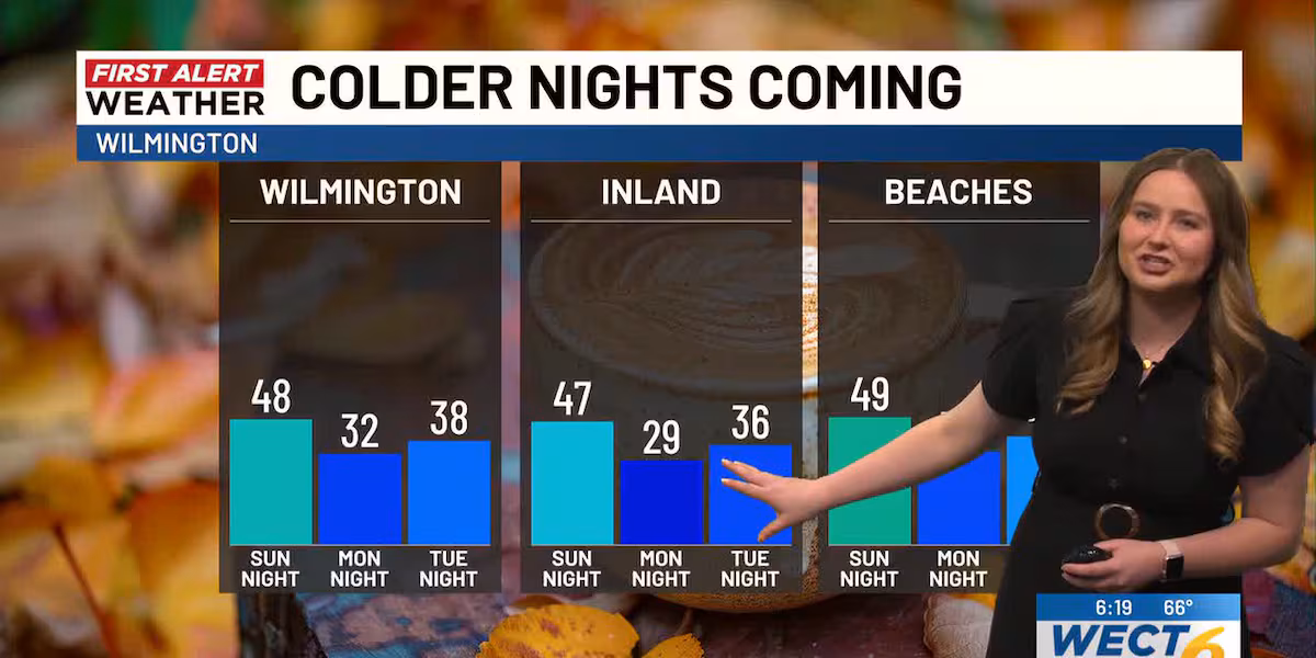
Following a strong cold frontal passage, expect a much chillier Monday with temperatures pinned in the 50s. For Monday night: get your heavier layers on standby, and have a plan for any sensitive plants as readings make a run for the freezing mark for the first time this fall. Tuesday night, it should be noted, will feature temperatures almost as cold, and arguably a better chance of frost. To highlight this sharply colder change, your First Alert Weather Team has hoisted First Alert Weather Days for this period.
Other First Alert Forecast highlights in the next ten days include the likelihood of a temperature rebound late next week and, all the while, new tropical storm development remains unlikely across the Atlantic Basin.
Extend your forecast here: webpubcontent.gray.tv/wect/MAXSevendayWECT.jpg
Customize your First Alert Forecast experience with your WECT Weather App.
Copyright 2025 WECT. All rights reserved.