A strong cold front will come through late Sunday and into Monday morning, bringing well below normal temperatures.
What You Need To Know
- Highs will struggle to make it into the 60s in some spots
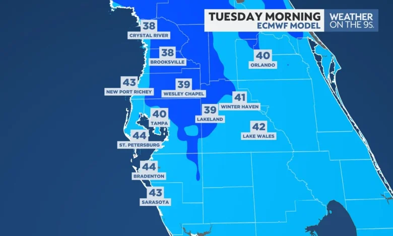
- Morning lows on Tuesday will be in the 30s and 40s
- Milder air returns Wednesday afternoon
A few showers will be possible late Sunday ahead of a cold front.
Showers will clear the area by mid-morning on Monday, then winds will pick up out of the northwest.
Winds could gust over 30 mph at times during the day on Monday, with gusts of 20 to 30 mph Monday night and into Tuesday.
The chilly north to northwest wind will keep highs in the 60s on Monday.
Temperatures will continue to drop Monday night.
By Tuesday morning, temperatures in Tampa will be near its record low for the day of 40 degrees. Wind chills could be in the low to mid-30s.
Morning lows in the 30s seem likely north of Tampa, with a low chance of temperatures near freezing in parts of Citrus and Hernando counties.
Highs on Tuesday may struggle to break 60 degrees north of Tampa.
Wednesday will start chilly once again, but afternoon highs will reach the 70s as abundant sunshine returns.
Our team of meteorologists dives deep into the science of weather and breaks down timely weather data and information. To view more weather and climate stories, check out our weather blogs section.