ATLANTA – The first freeze warning of the season has been issued by the National Weather Service. North Georgia will see a blast of Arctic air pushing into the Peach State, bringing sub-freezing temperatures and the potential for the first hard freeze by Tuesday morning.
KEEP UP WITH THE LATEST BY DOWNLOADING THE FREE FOX 5 STORM TEAM APP AND FOLLOWING @FOX5STORMTEAM ON X, FORMERLY TWITTER
Freeze warning and watch
The backstory:
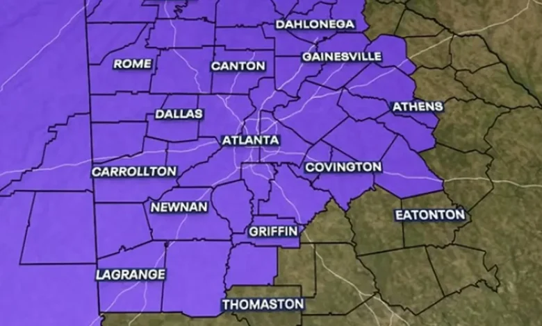
The Freeze Warning takes effect from 1 a.m. to 10 a.m. Monday across much of north and west-central Georgia, including metro Atlanta, Rome, Gainesville, Carrollton, and Marietta.
A broader Freeze Watch follows Monday night into Tuesday morning, when forecasters expect an even stronger shot of cold air that could drive temperatures into the low 20s across north Georgia and upper 20s across metro Atlanta.
The FOX 5 Storm Team said this will likely mark the end of the growing season as a widespread hard freeze settles over the state.
What about the wind chills?
What they’re saying:
Gusty winds and dangerous wind chills could make it feel like the teens by early Monday.
“We’re gonna see those temperatures really take a drop,” a FOX 5 Storm Team meteorologist Laurann Robinson said. “We’re also gonna continue to watch for those gusty winds.”
Lows are expected to fall into the upper 20s and low 30s, while wind chill values could dip into the teens by sunrise Monday.
By Tuesday afternoon, conditions should slowly improve with wind chill values in the upper 30s and lower 40s. Temperatures will then warm back into the 70s by the weekend.
“All in all, what this means is across North Georgia, overnight, if you do have exposed pipes, you wanna make sure you get those covered,” the meteorologist said. “Sensitive vegetation or plants, you wanna cover those up or bring them inside. You certainly wanna make sure you’re checking on your relatives and friends, and you also wanna make sure you’re bringing those pets indoors.”
Flurries in Atlanta; some snow in the mountains
Dig deeper:
The FOX 5 Storm Teams says North Georgia could see more than just a few flurries Tuesday, with snow showers likely in higher elevations.
Snow is expected Tuesday afternoon and evening above 1,500 feet in Dawson, Lumpkin, Fannin, Gilmer, Union, Towns, White, and Rabun counties.
Metro Atlanta is not included in the snowfall area, though a few stray flurries can’t be ruled out.
Minor travel impacts are possible in the mountain counties during the evening commute and early Tuesday morning. Freezing temperatures ahead of the system could allow snow to stick quickly.
At the highest mountain peaks, totals could reach up to 2 inches.
Potential hazards and precautions
What we know:
The FOX 5 Storm Team warned that frost and freezing conditions could kill crops and sensitive vegetation and may also damage unprotected outdoor plumbing.
Residents are urged to cover or bring inside potted plants, wrap exposed pipes, and allow faucets to drip overnight. Pet owners should ensure animals have warm shelter, and those using space heaters are reminded to follow fire safety precautions.
SEE ALSO:
Arctic blast in Georgia
By the numbers:
In Atlanta, overnight lows are expected near 32 degrees, with gusty northwest winds up to 30 miles per hour making it feel even colder. Monday’s high will struggle to reach 41 degrees. Temperatures will drop again Monday night, reaching 27 degrees by early Tuesday.
In the north Georgia mountains, colder air will dominate. Blairsville, Blue Ridge, and Hiawassee could see lows in the upper teens to low 20s, with occasional flurries possible through early Monday morning and again Monday evening. Winds gusting to 25 or 30 miles per hour will push wind-chill values into the single digits at higher elevations.
FAA airport flight cuts helping avoid crisis, expert says
Edward Segal, an expert in crisis management and the author of “The Crisis Casebook” says the FAA’s decision to cancel flights is the best way to manage and avoid a crisis. He sits down with FOX LOCAL’s Eric Perry for a full discussion on what he says the positives are.
After Georgia’s deep freeze
Local perspective:
After the deep freeze, temperatures will gradually rebound through midweek.
In Atlanta, highs are expected to climb from the upper 40s on Veterans Day to near 70 degrees by Friday and Saturday.
The north Georgia mountains will follow a similar warming trend, with highs returning to the 60s by late week.
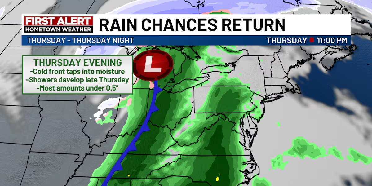
Forecasters say skies will remain mostly clear and dry through Friday, though some models hint at another cold front and possible showers by next weekend.
Metro Atlanta workweek forecast
What’s next:
The workweek begins cold but ends mild.
Monday and Tuesday will bring the coldest air of the season before sunshine and lighter winds return midweek.
By Thursday and Friday, highs in metro Atlanta are expected to reach the upper 60s to low 70s under mostly sunny skies.
The FOX 5 Storm Team says residents can expect dry, pleasant fall conditions through the week before the next front approaches.
The Source: This article is based on an original forecast by the FOX 5 Storm Team with details about warnings and watches from the National Weather Service.
Winter WeatherNewsGeorgiaAtlanta