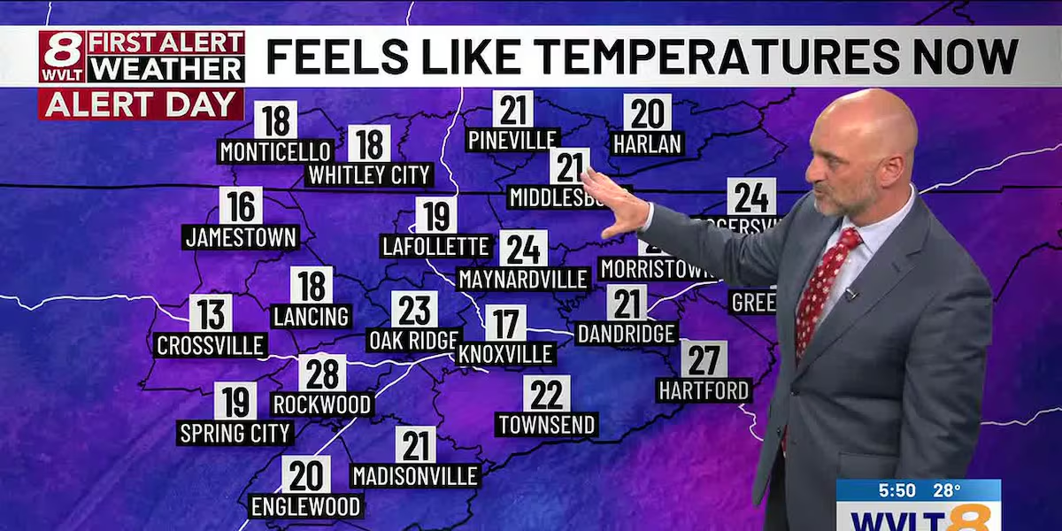
KNOXVILLE, Tenn. (WVLT) – Snow showers and flurries will continue, mainly in the mountains and foothills, then taper off after midnight. Additional snow totals of 1-3″ in the highest elevations of the Smokies. Lows will drop into the low to mid 20s with feels-like temperatures in the teens.
Feels-Like Forecast(WVLT)
FIRST ALERT WEATHER DAY FOR FRIGID MORNING! Highs will reach the low to mid 40s with sunshine thawing many areas out. A few clouds may return late in the day. Winds will be west at 10-15 mph making it feel like the 30s all day.
WEDNESDAY: Mostly sunny and warmer with highs in the mid to upper 50s and lows in the upper 30s.
LATE WEEK: Highs will top out around 60 or so both Thursday and Friday with a mix of sun and clouds. Morning lows will be in the upper 40s.
WEEKEND: Highs will warm into the upper 60s to near 70 with increasing clouds by Sunday. A stray shower is possible either day.
Spencer Denton – First Alert Meteorologist
FACEBOOK: Meteorologist Spencer Denton
X: @dentonwx
Instagram: Spencer_Weather
8 Day(WVLT)
Copyright 2025 WVLT. All rights reserved.