Meteorologists warn that an “extraordinary and unique” atmospheric event could reshape the 2025-2026 winter outlook. A rare, possible disruption of the polar vortex—which determines how cold it gets—or strengthening La Nina conditions—which influence where cold air travels—may significantly alter typical U.S. winter weather patterns, potentially leading to colder and snowier conditions than usual.
Why It Matters
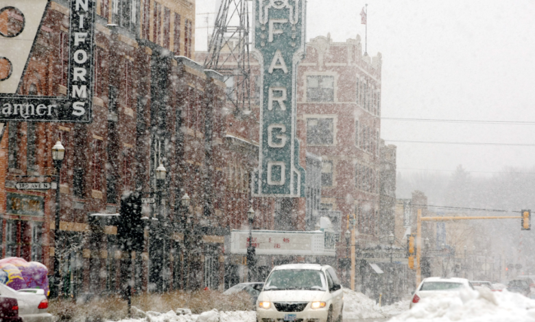
A disruption of the polar vortex could send a blast of cold, arctic air into parts of the U.S., which may lead to below-average temperatures, heavy snow, and potentially dangerous wintry conditions, starting earlier than usual in December and lasting longer than normal, until January.
What To Know
According to meteorologists and climatologists, critical changes in two major atmospheric patterns—La Nina and the polar vortex—have put the U.S. at a possible “fork in the road” that will decide how the 2025-2026 winter unfolds.
One scenario predicts that a sudden stratospheric warming (SSW)—a rare shift in temperature, high above the North Pole—could disrupt the polar vortex, which normally keeps frigid Arctic air confined to the region. As a result, the disturbed polar vortex may push cold air further south, into the U.S., potentially blanketing parts of the nation with extended cold and snowy conditions, starting in December and lasting through to January.
The other scenario suggests that the ongoing La Nina—although marked by cooler-than-average Pacific waters—will remain the primary driver of more typical winter weather. Historically, La Nina winters bring warmer conditions to the southern and eastern U.S., and cooler, wetter weather to the northern tier.
What People Are Saying
Judah Cohen, an MIT climatologist, told USA Today: “A sudden stratospheric warming [is] the largest type of disruption that occurs to the polar vortex. It is named because of the dramatic warming that occurs in the polar stratosphere (warming near the North Pole can exceed 100 degrees in just a few days). The warming displaces the polar vortex much further south than normal.”
Celeste Saulo, secretary-general of the World Meteorological Organization, said: “Seasonal forecasts for El Niño and La Nina and their associated impacts on our weather are an important climate intelligence tool. They translate into millions of dollars of economic savings for key sectors like agriculture, energy, health, and transport, and have saved thousands of lives when used to guide preparedness and response actions.”
What Happens Next
The impact of the potential SSW will become clearer toward the end of November and into December. If historical trends from previous SSW events hold, Americans could see an extended period of colder and snowier weather, lasting into early January. For comparison, the last notable November SSW event in December 2000 led to almost three weeks of subzero highs and substantial snow—up to 13.4 inches—across parts of the upper Midwest.