Residents across several states in the U.S. have been warned by the National Weather Service (NWS) to expect as much as 20 inches of snow to fall by Monday night, with some areas seeing snowfall until Wednesday.
Why It Matters
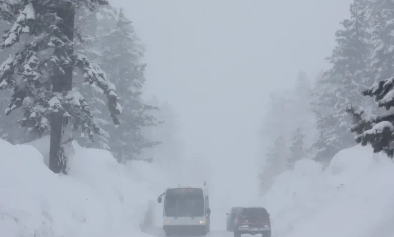
Heavy snowfall is expected to impact travel, making roads slippery and dangerous—especially during the morning and evening commutes in affected areas. There is also a chance of blizzard conditions developing in areas hit with high winds, which could reduce visibility, making driving conditions extremely difficult.
What To Know
Klondike Highway, north of MP 6 in Alaska, is expected to get up to 5 inches throughout Monday, with the heaviest snowfall in the afternoon, where over 0.5 inches could fall per hour. The interior Kenai Peninsula—including Moose Pass and Turnagain Pass—might get up to 10 inches of snow, with as much as 2 inches falling per hour into Monday morning, and Rabbit Pass could see between 4 and 10 inches of snow and up to 50 mph winds until Monday evening.
Portage and Whittier should brace themselves for up to 20 inches of snow and 45 mph winds until Monday evening, and the eastern Norton Sound and Nulato Hills, Lower Yukon River, and Yukon Delta Coast could get up to 8 inches with 45 mph winds from Sunday night until Wednesday afternoon. Up to 10 inches with winds as high as 60 mph could hit parts of St Lawrence Island.
Areas of Colorado, including the Elkhead and Park Range Mountains, could see between 4 and 8 inches of snowfall until late afternoon on Monday.
Wind River Mountains west, Teton and Gros Ventre Mountains, and the Salt River and Wyoming Ranges could get up to 10 inches of snow through Monday, and the Sierra Madre Range and Snowy Range in Wyoming could see up to 12 inches—more is expected in higher areas—with winds as high as 50 mph.
Wayne and Northern Cayuga counties could get between 2 and 5 inches, with 35 mph winds creating blowing snow in some open areas, which is expected to last from Monday afternoon until Tuesday morning. Snow accumulations between 7 and 14 inches are expected in northern Herkimer County, mainly near and north of Route 28.
Parts of central California should prepare to see up to 12 inches in areas above 7,000 feet, by Monday evening, and parts of the far northwestern Hamilton counties might get up to 9 inches.
The Greater Lake Tahoe area should expect up to 12 inches above 6,500 feet, with 50 mph winds along the ridges, and Mono County should prepare to see 15 inches above 8,500 feet, with 40 mph winds.
West Slope Northern Sierra Nevada and Western Plumas and Lassen Park counties might see up to 2 feet of snow on the highest peaks, with 40 mph winds, until Monday afternoon, and White and Inyo Mountains, and eastern Sierra Slopes could see up to 12 inches in areas above 9,500 feet until Tuesday night—with State Route 168 to Aspendell and through Westgard Pass particularly affected by slippery road conditions.
Between 9 and 15 inches of snow is expected in areas above 8,000 feet in Esmeralda and Central Nye County, making travel difficult, especially along State Route 266 through Lida Summit, and up to 24 inches could land on Sheep Range and Spring Mountains-Red Rock Canyon by Wednesday morning, making travel “difficult to impossible” along State Routes 156, 157, and 158.
What People Are Saying
The NWS for Wyoming said: “Outdoor recreation could become dangerous to those caught unprepared for hazardous winter conditions. Hunters and hikers may become disoriented and lost due to low visibility in falling and blowing snow. Areas of blowing snow could reduce visibility and lead to slick road conditions.”
The NWS for Nevada said (specifically about the Lake Tahoe area): “Small boats, kayaks, and paddle boards will be prone to capsizing and should remain off lake waters until conditions improve. Consider postponing boating activities on the lake until a day with less wind.”
What Happens Next
The NWS said that this first system will move north, meaning conditions might “briefly improve” before a second system moves in midweek.