Forecasters issued the yellow alert today and said there will be a number of wintry showers beginning on Tuesday evening into Wednesday morning across the country.
The Met Office confirmed the alert is in place from midnight until noon on Wednesday, with icy patches and lying snow in places and possibly travel delays.
The spokesperson added: “Frequent wintry showers will feed inland through Tuesday night and into Wednesday morning across Northern Ireland, with strong northerly winds blowing showers well inland.
“Whilst little to no snow accumulations are expected at low levels, 1-3 cm is likely over higher ground, and perhaps very locally up to 5 cm.
“This may affect routes such as the Glenshane Pass and Coleraine Mountain road.
“Ice will be likely on untreated surfaces, whilst hail and lightning will be additional hazards.”
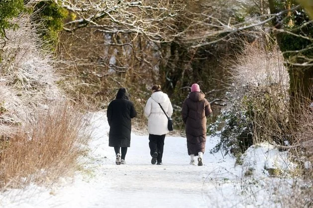
Snow and ice in east Belfast in 2022. Picture by Jonathan Porter/PressEye
The Met Office urged people to take additional precautions, including leaving extra time for their journeys that morning and keeping up to date with public transport.
It comes as similar alerts have been issued in other parts of the UK as the milder start to November begins to disappear.
The Met Office has issued multiple yellow weather warnings for snow and ice affecting parts of Scotland and northern England from Monday to Thursday, with sub-zero temperatures expected during the first cold snap of the winter.
Met office meteorologist Alex Burkill said cold air is coming from Siberia and crossing over the Arctic ocean to the UK.
Wet weather is expected across Scotland, Northern Ireland, and northern and western parts of England and Wales on Tuesday.
“With that cold air we have across us, no wonder we are going to see some sleet and snow mixed in with that as well,” Mr Burkill added.
He continued: “There is an area of low pressure that’s pushing its way southwards as we go through Tuesday night and into Wednesday, and that’s bringing the focus for that burst of showery rain, with a bit of sleet, bit of hill snow mixed in, but a lot of that is going to be clearing away towards the south as we go through the morning.
“I’m not sure how much wintry stuff we’re going to see across the southern areas, mostly just falling as rain.
Snowy conditions at Cavehill earlier this year. Picture by Jonathan Porter/PressEye
News Catch Up – Tuesday 18 November
“Then once that clears away, we just have this brisk northerly wind that’s piling down, the Arctic air coming through.
“And because of the direction that that wind is coming from, it’s really pivotal to where we see further showery bursts of rain, sleet and snow.
“So yes, northern parts of Scotland seeing plenty, and also down the eastern side of England and eastern Scotland as well – plenty of these rain, sleet and snow showers.”
Temperatures for much of the UK will be down “a couple of degrees” on Wednesday, including across the south where it will turn colder than average for this time of year.
“Watch out for some brisk winds, particularly towards the west, could be close to gales through both Wednesday and Thursday,” Mr Burkill said.
“That will add to the cold feel for many places, too.”