Live updates: Tropical Cyclone Fina changes direction, remains headed for NT coast; Category one storm forecast to strengthen; Tiwi Islands, Cobourg Peninsula in firing line
The Bureau of Meteorology and Northern Territory Police are giving an update on Cyclone Fina from Darwin.
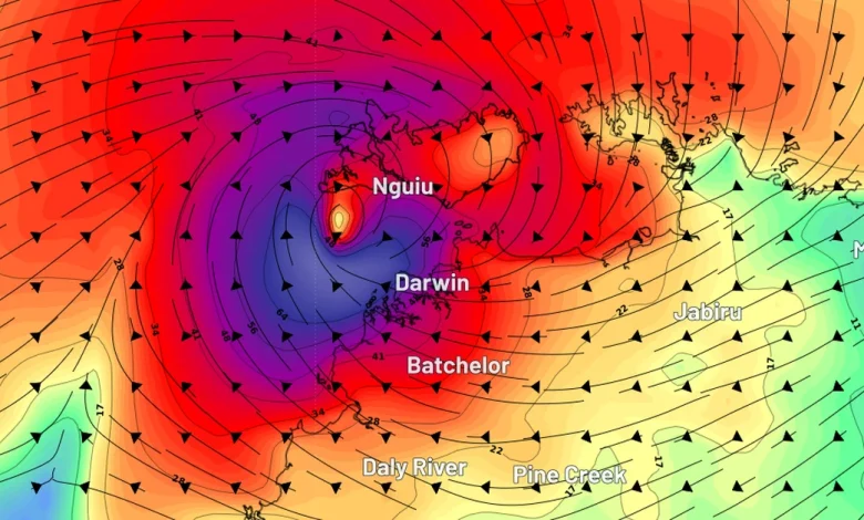
BoM NT hazard preparedness and response manager Shenagh Gamble says the most severe impacts will be felt in Darwin tomorrow.
“The worst of the conditions in Darwin are expected to be during the day tomorrow and into tomorrow evening,” she says.
“There may be periods during the day where conditions seem to ease, and this is typical during a cyclone event, but it will be temporary, so do not assume that the danger has passed until you have been advised that it.”
She adds that dangerous winds will develop.
“The winds will strengthen to 100km an hour with stronger gusts of 120km an hour in the warning area,” Gamble says.
“Destructive wind gusts of 150km an hour could develop during this evening in the warning area as the system nears the coast.”
The impacts may also be felt outside the cyclone watch area.
“Severe thunderstorms with destructive winds could develop as far east as Groote Island,” Gamble says.
“A flood watch is current for much of the northern Top End. Daily rainfall totals of 200mm and more are expected in this flood watch area.”