It’s all about the timing
The strange part is how early this is all unfolding. In fact, only three November SSW events have been documented in 70 years.
So, why should we care down here?
There have only been three November SSWs on record, so the historical sample is limited, but in those cases, December trended downright frigid across portions of Canada. Early-December SSWs in the historical record have also shown a similar tendency toward colder patterns.
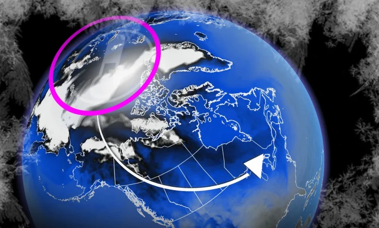
The disruption is working its way down
Models now show the disruption descending from the upper stratosphere. Forecasters monitor the lower stratosphere (around 16 km), where a slowdown in west-to-east (zonal) winds signals that the disturbance is beginning to couple downward with the troposphere. That is the layer where our day-to-day weather forms.
Once that connection is made, the pattern can shift at the surface, increasing the likelihood of Arctic air intrusions, blocking highs, and a wavier jet stream. Some regions, including parts of the Arctic itself, can actually run warmer than normal during these patterns!
The atmosphere was already gearing up for a shift
Even before the SSW appeared, other teleconnections were pointing toward a significant pattern change, suggesting colder conditions were already possible. The SSW is now a new, wild card player that could extend or reinforce a colder pattern late into December and into early 2026.
What happens next with the polar vortex?
That’s the million-dollar question.