COLUMBIA, S.C. (WIS) – Rain chances hold off for the Midlands until the middle of the week courtesy of an incoming cold front.
wis(wis)
First Alert Headlines
- Nice and sunny forecast in store Sunday.
- Next cold front brings chance of rain late Tuesday into Wednesday.
- Much cooler air filters in by Thanksgiving Day.
First Alert Summary
Sunday will be a beautiful day to spend outside with plenty of sunshine to go around. High temperatures are expected to reach the lower to middle 70s to wrap up the weekend.
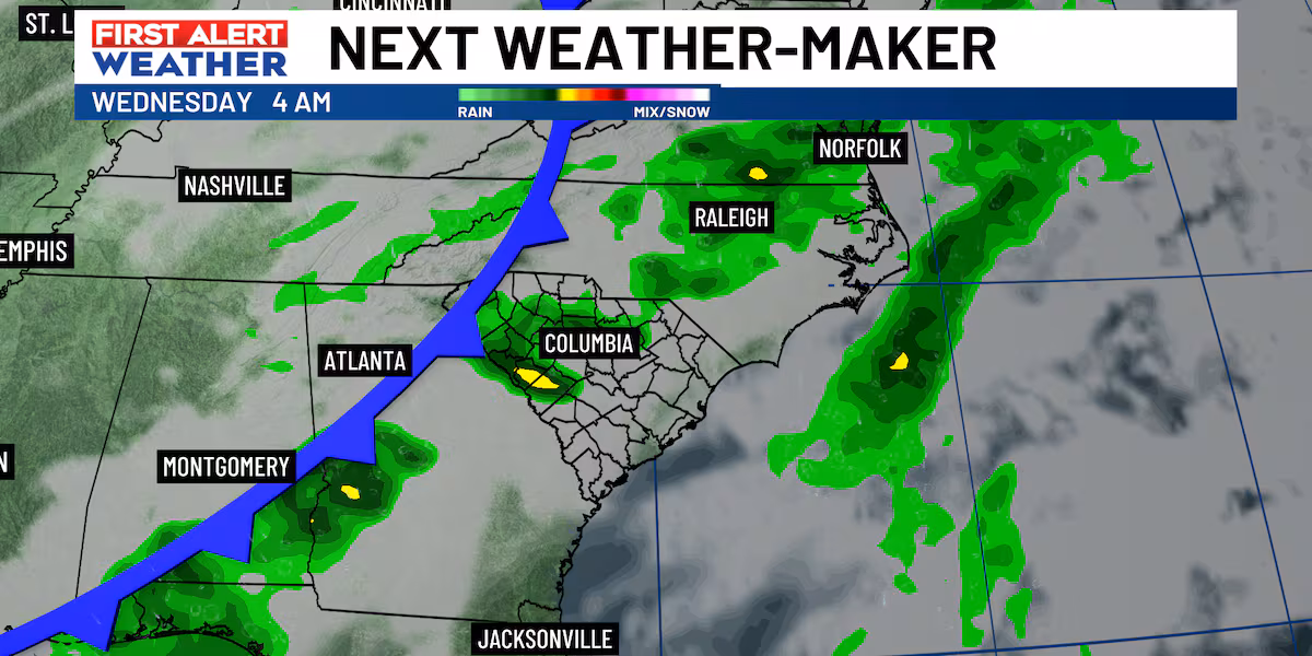
Heading into the week, we’ll be looking ahead to our next weather-maker. A stronger cold front is forecast to swing into the region by late Tuesday into Wednesday. There will be a chance of rain during this timeframe with the passage of this front.
wis(wis)
Fortunately, rain chances should come to an end for Thanksgiving Day on Thursday as dry and cool air filters in. Temperatures behind this front will drop off below normal by the end of the week with highs likely in the 50s and morning lows near freezing.
wis(wis)wis(wis)
First Alert Forecast:
Sunday: Mostly sunny. Highs in the lower to middle 70s.
Monday: Mostly sunny. Highs near 70-degrees.
Tuesday: Cloudy. 20% chance of rain. Highs in the middle 70s.
Wednesday: Chance of showers. Chance of rain 40%. Highs in the lower to middle 70s.
Thanksgiving Day: Sunny and cooler. Highs in the upper 50s to near 60-degrees.
wis(wis)
Feel more informed, prepared, and connected with WIS. For more free content like this, subscribe to our email newsletter, and download our apps. Have feedback that can help us improve? Click here.
WATCH US LIVE
Watch WIS live during newscasts and Soda City Living in the livestream player below. When WIS is not on the air, the player will feature Gray Media’s Local News Live.
Copyright 2025 WIS. All rights reserved.