After weeks of violent storms, more severe weather is on the way for Queensland’s south east as well as northern NSW, with destructive winds and giant hail forecast.
The area south of Brisbane was thrashed by hail as big as golf balls last night, caused by a supercell that roared across the Scenic Rim and Logan, Weatherzone said.
Locals are being told this afternoon and evening there’s a change of more dangerous supercell storms with reports of hail already falling at Logan, Mount Tamborine and across the border in Murwillumbah.
Giant hail fell on the Gold Coast last night. (Supplied)Lightning lights up the Brisbane sky on Sunday. (Arch Media Studio)
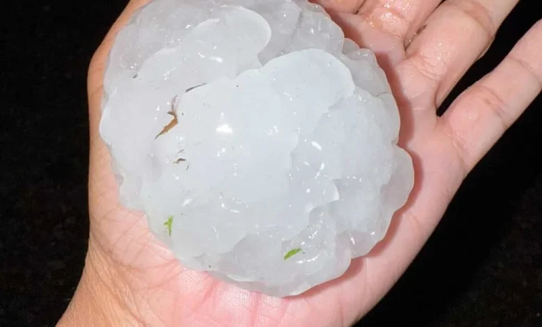
Higgins Storm Chasing reported hail larger than 10cm has fallen at Cornubia in Logan this afternoon.
“Monday has all the ingredients for further severe thunderstorm development over northeast NSW and southeast Qld,” Ben Domensino said earlier today.
“Monday’s severe thunderstorms are likely to cause heavy rain, damaging wind gusts in excess of 90 km/h and large hail measuring larger than 2cm in diameter in some areas.
The Bureau of Meteorology has also issued a warning.
Supercell storms are possible this afternoon and evening. (Supplied)Last week thousands were left without power as the latest storm smashed the Brisbane region. (Nine)
It covers the northern rivers area south of the Queensland border as well as Queensland’s Beaudesert, Beenleigh and Canungra by 2.50pm and Logan Central, Cleveland and Jimboomba in Queensland by 3.20pm local time.
“A warm and humid airmass is combining with a southerly wind change and a low-pressure trough to trigger severe thunderstorms across the Northern Rivers this afternoon.” it said.
“Severe thunderstorms are generally moving to the north and northeast and are expected to contract towards the Queensland border. Severe thunderstorms also moving into the southwest of the State.”
Storms are forecast for the rest of the week.