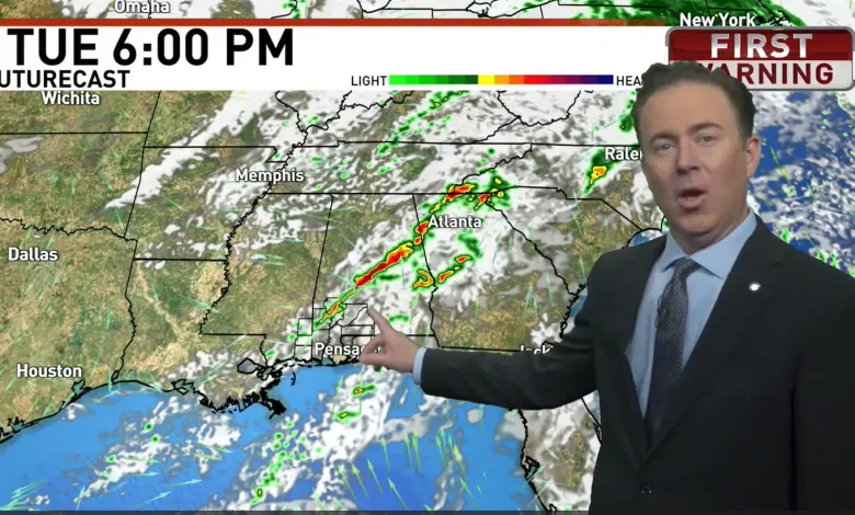
WEAR-TV — A batch of storms will develop Tuesday morning into afternoon ahead of a cold frontal boundary, with the warm, humid air mass in place ahead of it. This weather maker could bring strong to severe storms to parts of the South. The main threats are damaging wind gusts (potentially over ~60 mph), isolated hail (around quarter-size), and a low-end risk for a brief tornado. While the core of the risk is inland (especially MS/AL), storms could drift toward coastal zones or move onshore.
The severe weather outlook has the WEAR-TV zone in a level 1 out of 5 on Tuesday.
The Tuesday severe weather outlook has the WEAR-TV zone in a level 1 out of 5, depicted by the green area. This means a strong to severe storm could pop up in this zone. The yellow zone over Alabama is a level 2 out of 5 or slight risk area.{ }
Parts of Mississippi and Alabama are in a level 2 out of 5.
On Monday, the Storm Prediction Center said, “Isolated severe storms are likely across parts of the Southeast/Deep South, mainly from Tuesday morning into early evening. A couple tornadoes are possible in parts of eastern Mississippi and Alabama.”
The weather certainly may have an impact on travel Tuesday but if you have travel plans or are expecting people from out of town on Wednesday, the weather looks great.
Comment with Bubbles
BE THE FIRST TO COMMENT
Once this weather maker moves out, the weather will dramatically cool down across the South.