Temperatures are set to plummet once more – dropping to as low as -4C in the coming days – as snow and a “rare weather phenomenon” approaches.
Britons will encounter freezing rain, which the Met Office warns can occasionally bring down trees and power lines, as another band of low pressure moves across the nation from the north. In areas where conditions aren’t quite cold enough for snow, the freezing rain – an uncommon type of liquid precipitation – will descend.
Dramatic weather maps indicate these wintry showers are probable through Sunday night and into Monday morning, with the heaviest falls during the early hours. Snow is forecast as far south as Greater Manchester, although significant settling is unlikely.
Residents across most of Scotland, Northumberland, Cumbria and County Durham are expected to experience the heaviest freezing rain, meaning many will awaken to ground frost and treacherous road conditions.
The Met Office has previously cautioned about the dangers of freezing rain, an infrequently observed weather phenomenon in the UK.
It stated: “The weight of the ice can sometimes be heavy enough to bring down trees and power lines, and the glaze of ice on the ground effectively turns roads and pathways into an ice rink. The freezing rain can also prove extremely hazardous for aircraft.”
“Freezing rain is more common in other parts of the world, for example in the USA, where weather systems produce a lot of freezing rain. These are called ice storms, and if enough glaze collects on trees or power lines, the weight of the ice can cause them to break and can result in disruption on a large scale.”
The white stuff will become more widespread during the early hours of Monday morning. Weather maps from Metdesk indicate the most significant snowfall will affect south Lancashire, Cumbria, Dumfries and Galloway, and Argyll and Bute.
Recent days have seen relatively mild conditions – reaching 16C in Hawarden, north Wales, on Thursday. But a sharp decline is anticipated, with temperatures dropping to -4C on Sunday ahead of the snow showers.
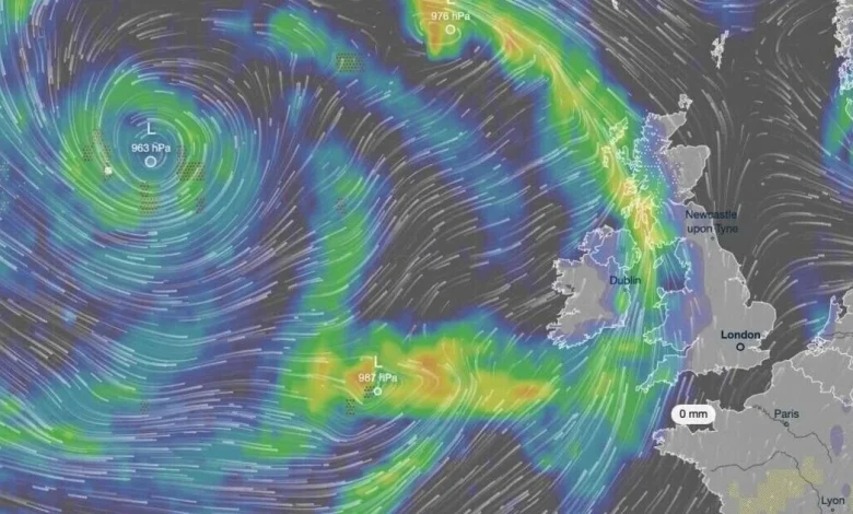
Western and northern regions will bear the brunt of the coldest weather in the days ahead, driven partly by strong winds sweeping in from the North Atlantic, experts say.
Met Office Deputy Chief Meteorologist Steven Keates said: “Confidence is high that the weekend will be unsettled, but there remains some uncertainty over the exact track of the low-pressure system.
Small shifts in its path could significantly affect where the heaviest rain and strongest winds occur. This means that while some areas may experience disruptive conditions, others could see much less severe impacts.”