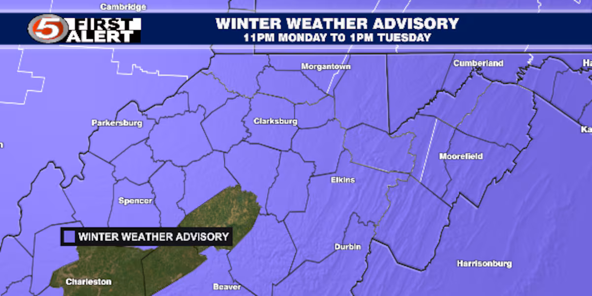
BRIDGEPORT, W.Va (WDTV) – Snow and rain could make for tricky travel on Tuesday morning. However, some ice could make it dangerous. All three types of precipitation are possible starting after 3:00 am.
Today is the proverbial ‘quiet before the storm’, literally. Cold today with clouds and sun at times. Precipitation with our storm system on Tuesday will start approximately around 3:00 am. This will overspread all of NCWV by sunrise. The big question is, what can you expect? The answer is, it depends, especially on where you are.
Tuesday, 3:00 am through 7:00 am:
Rain, snow, and some ice will be around during this time. The most probable location for ice will be in the mountains of Preston, Pocahontas, Randolph, and Tucker counties. The best chance for snow will be near the Ohio River and north of US-50. Elsewhere, mainly rain.
All that being said: Snow could mix with ice in the mountains. Where mainly rain is expected, that could also begin as a period of snow. The best chance for snow from beginning to end (of this event) looks to be toward the Ohio River and north of US-50.
Rain, snow, and some ice.(Gray Media, Inc.)
Tuesday, 7:00 am through 1:00 pm:
Rain will start to turn to snow showers west of I-79 as cold air moves east. Any ice in the mountains will move out of NCWV. Snow levels will rise and should transition to rain in the mountains.
All that being said: While snow levels will rise later in the morning, it could stay cold. Some of the highest elevations may not get warm enough to see rain. Therefore, snow and ice could continue.
Snow to rain?(Gray Media, Inc.)
Tuesday, 1:00 pm through midnight:
Precipitation should become snow at all elevations during the afternoon. Snow should be coming to an end before sunset. Additional accumulations are possible during this time.
All that being said: Snow showers could continue into the mountains overnight. Additional light accumulations are possible.
Additional accumulations.(Gray Media, Inc.)
Snowfall totals:
Snow totals shown on the map are HIGHLY dependent on where the “warm” air ahead of this storm system goes. If it goes farther north, snow totals could be lower. If it stays farther south, they would be higher. The more it rains, the less moisture is available for snow. The track of the center of the area of low pressure will determine rain versus snow. This is because the temperatures (through the lower depths of the atmosphere) will be hovering around the freezing mark (above and below). Here is what it looks like as of now (Monday morning forecast).
Higher totals north, west, and in the mountains.(Gray Media, Inc.)
Dry and cold with some sun on Wednesday, then a few snow showers on Thursday morning. Another chance for some rain and snow showers on Friday. This looks to be most likely south of US-33. Rain versus snow will depend on elevation. Cold and dry on Saturday, Sunday, and into next week.
Copyright 2025 WDTV. All rights reserved.