(This article has been updated with new information.)
Road conditions around Indianapolis deteriorated quickly Dec. 1, within minutes of snow starting to fall just before the evening commute. Slide-offs and vehicle crash calls began hitting 911 dispatc,h with the snow expected to continue through much of the night.
A winter weather advisory went into effect for Indianapolis and surrounding areas at 5 p.m. Dec. 1 and it didn’t take long for drivers to feel the impact.
“A heavy snow band moving across areas of Central Indiana, generally north of I-70, will continue to produce a quick burst of snow accumulation and deteriorating road conditions as evidenced by recent INDOT snow plow cameras. Drive slow and leave plenty of room in front of you,” NWS Indianapolis posted to social media shortly after 5 p.m.
The advisory will remain in effect until at least 7 a.m. Dec. 2.
Snow is expected to reach accumulations between 2 and 5 inches in portions of central, east central and west central Indiana. This could create dangerously slick road conditions.
“It looks like a quick-moving snow system, but it could bring some heavier snow rates at times,” said Aaron Updike, a meteorologist with the National Weather Service.
IMPD responds to at least 50 crashes
As roads became slick in the afternoon, the Indianapolis Metropolitan Police Department responded to at least 50 car crashes or accidents between 5 p.m. to 7 p.m., according to Tommy Thompson, IMPD public information officer.
At least 10 of the crashes were unfounded, according to Thompson.
NWS and local officials recommend people drive slowly and carefully this evening, as snow crews across Indianapolis treat the roads and highways.
NWS Indianapolis publishes first official snow total
Shortly after 7 p.m., NWS Indianapolis announced that the Indianapolis International Airport received about 1.7 inches of snow.
Meteorologists expect the Indianapolis Metropolitan area may receive an additional inch or two of snow throughout the night and into the early morning.
Indianapolis should expect light snow throughout the night
Shortly after 4:30 p.m., Central Indiana was hit with a quick burst of moderate snow, which dropped about an inch to an inch and a half of snow over the Indianapolis metro area, according to NWS Indianapolis.
Meteorologists predict that light snow will continue to fall over much of Central and Northern Indiana throughout the night, with snowfall intensifying in the early morning on Dec. 2.
“It does look like there may be another round of moderate snow intensity as we get toward midnight and early morning hours,” said Casey Crosby, meteorologist with NWS Indianapolis. “The snow should be done by 4 or 5 a.m. at the latest.”
Regarding additional snow totals, Crosby noted that some areas in Indianapolis could see about another inch or two of snow, but it will depend on how quickly and in what direction the snowstorm travels across Central Indiana throughout the night.
NWS warns commuters to drive safely as snow continues throughout the night
Much of the initial snowfall occurred before the end of most people’s work days, which left hundreds of commuters traveling on roads with icy and hazardous conditions.
Early NWS weather models predicted that the snow would not hit Central Indiana until 6 p.m., but Mother Nature arrived on her own time, with Indianapolis experiencing the first flakes at about 4:30 p.m.
Within a two-and-a-half-hour window, the Indianapolis Metropolitan Police Department had responded to more than 35 calls relating to either a car crash, a car sliding off the road or a person calling for help, according to IMPD’s report system. On a typical night, IMPD may respond to a half a dozen calls within an hour.
It’s unclear how many car crashes the Indiana State Police have handled since the snow began to fall over Central Indiana.
In Indianapolis, the city’s Department of Public Works said that crews have been rotating in 12-hour shifts to monitor and treat roads since late Nov. 28. Crews will remain on call until further notice.
NWS Indianapolis said they expect road conditions to improve as crews treat the roads and highways throughout Central Indiana. But Crosby warned commuters who live in rural areas to drive carefully, as many of the county roads will remain untreated throughout the evening and early morning.
“They still may be pretty slick and hazardous even in the morning after the snow ends,” Crosby said.
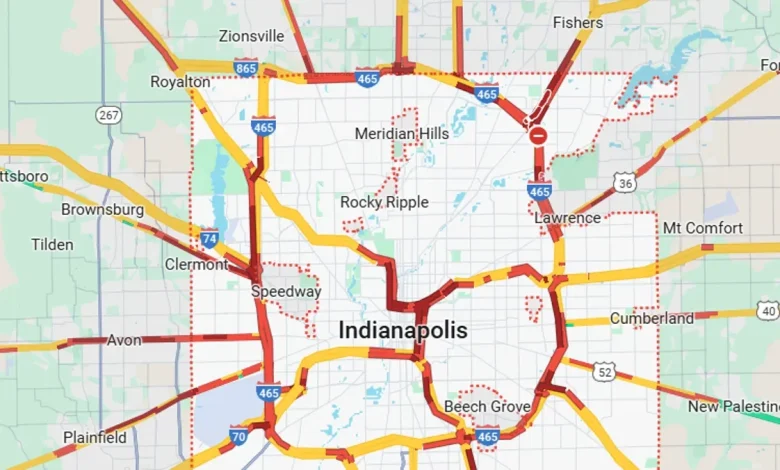
Indianapolis and Indiana road conditions
Check road conditions, including road closures, crashes and live webcams using Indiana’s online Trafficwise map at 511in.org, or visit our gridlock guide page for live traffic cams and more.
INDOT’s CARS Program provides information about road conditions, closures and width and weight restrictions. The website has a color-coded map of Indiana’s highways and highlights hazardous road conditions and travel delays.
The interactive map also shows road work warnings, closures, roadway restrictions and other information helpful to drivers.
Weather travel advisories
Cold front arriving on Thursday
While snow is expected to taper off Dec. 2, the cold temps will likely get worse Dec. 4.
Beginning late Wednesday, Dec. 3, an Arctic cold front is expected to bring frigid breezes and wind chills as low as zero that will linger through the morning of Friday, Dec. 5.
In Indianapolis, temperatures are expected to drop as low as 10 degrees on Dec. 4 due to arctic air and wind chill. Some cities, like Crawfordsville and Kokomo, are expected to reach temperatures as low as 0 degrees and -1 degrees.
Meteorologists recommend people wear multiple layers if they plan to go outside or spend time in frigid conditions. It is also recommended that people take shelter inside during these two days of extreme freezing temperatures.
People looking for a warming center in Indianapolis can visit the city government’s website at indy.gov/activity/indy-parks-severe-weather-plan.
Freezing fog in Northern Indiana
As temperatures remain below freezing on Dec. 1, a few regions in Northern Indiana are experiencing freezing fog due to the remaining snow from this weekend’s storm.
Freezing fog occurs when moisture in the air instantly freezes on contact with surfaces when temperatures are at or below freezing.
“That fog is creating a very thin layer of ice accumulation, especially on elevated surfaces,” Updike explained.
Meteorologists say that as temperatures begin to warm up throughout the day, these conditions should dissipate.
Was there a dome over Indianapolis this weekend?
The new round of predictions comes days after Indianapolis residents had their snow day thwarted by an apparent dome over the city.
Many online questioned why there appeared to be a “bubble” or “donut” surrounding Indianapolis, which showcased clear skies as the rest of Indiana saw heavy snowfall.
NWS meteorologists provided two explanations for the weather discrepancies over the weekend.
Regarding the radar, NWS Indianapolis meteorologist Updike explained that the dome or donut-shaped pattern that appeared on the radar was due to how the radar collects data.
“It shoots at an upward angle and so at a certain point, you’re going to see that kind of donut around the area because it’s not reaching the cloud level quite yet,” Updike said.
The other reason why it felt like Indianapolis was missing out on the fluffy stuff was due to a dry air mass that sat over the city and portions of Southern Indiana, which melted the snow before it could reach the ground.
“It was more of a north-to-south type of thing than it was a donut necessarily,” Updike said. “It did look like a donut on the radar, but it just flew at the radar the way it did.”
How drivers can prepare for bad winter weather
This video offers tips from the Indianapolis Department of Transportation to help drivers navigate bad winter weather conditions.
Weather info you need
🚨 Indiana Weather Alerts: Warnings, Watches and Advisories.
⚡ Indiana power outage map: How to check your status.
💻 Internet outages: How to track them.
🚫 What you should and shouldn’t do when the power is out.
🐶 Your neighbor left their pet outside. Who you should call.
Where to report power outages and downed lines
- AES Indiana customers: 317-261-8111
- Duke Energy customers: 1-800-343-3525
How to report downed traffic signals or tree limbs blocking a road
If you encounter a downed traffic signal or a limb blocking a roadway, contact the Mayor’s Action Center at 317-327-4622 or online at RequestIndy.gov. When calling after hours, press “2” to be connected.