Dangerously cold temperatures are forecast to overspread Michigan in the next day or two, sending our daytime highs tumbling far below normal levels and creating sub-zero wind chills in some areas.
This Arctic blast is expected to be the first of three such waves of cold coming at us over the next couple of weeks – and it’s all because of a shift in how the Polar Vortex is situated, meteorologists have said. It’s allowing much colder air that typically stays well north of us to filter down into Michigan.
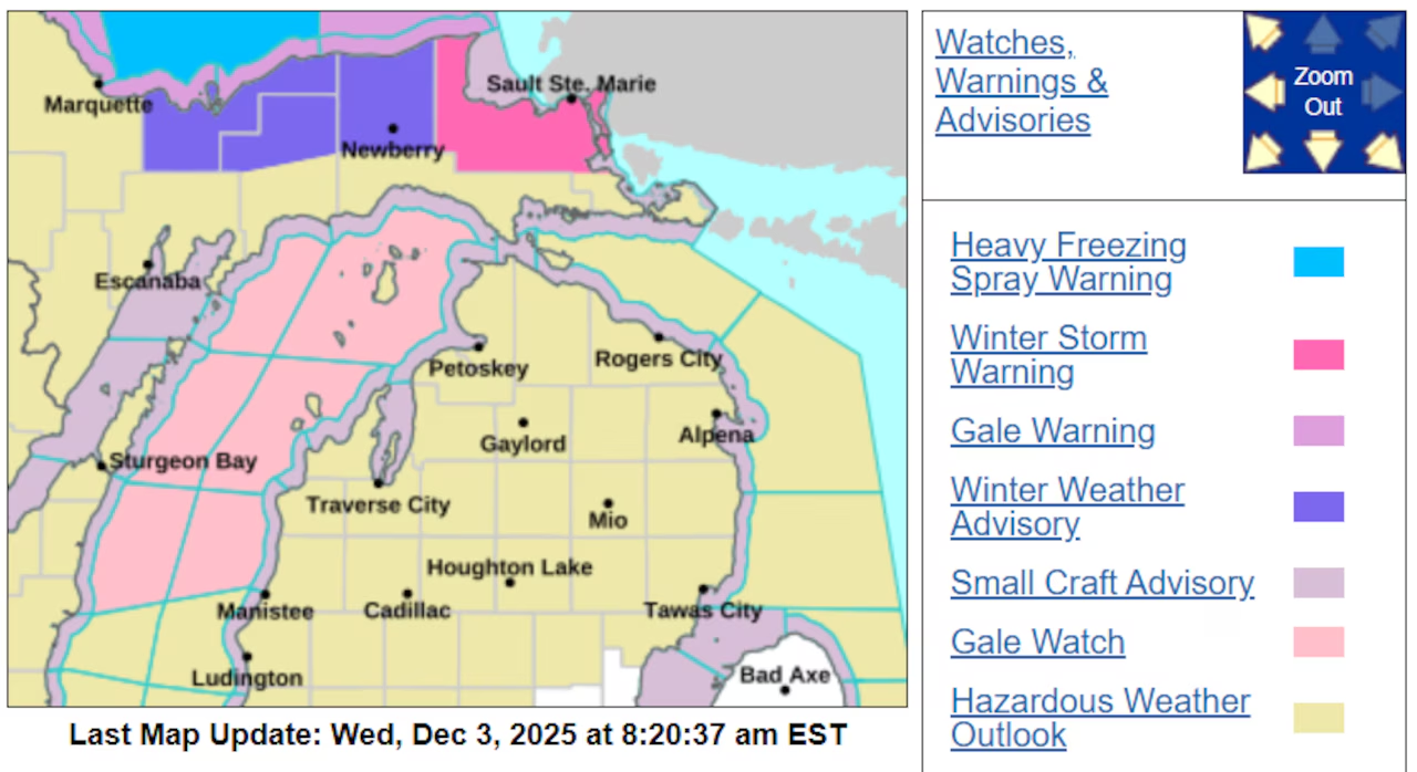
Snow is also coming with this cold front. For most of us, it won’t be a heavy snow. But for the eastern Upper Peninsula, up to a foot of snow could pile up between now and Thursday, the National Weather Service in Marquette has said. They issued a Winter Storm Warning for Chippewa County today. It will remain in effect until 1 p.m. on Thursday.
In addition to the heavy snow, that area could see wind gusts up to 35 mph, which could cause travel issues.
“Visibilities may drop below 1/4 mile due to falling and blowing snow,” the Winter Storm Warning says. “Travel could be very difficult. The hazardous conditions could impact the Thursday morning commute.”
Here are the forecast highlights from the National Weather Service offices across Michigan:
A Winter Storm Warning is in effect for northern Chippewa County in Michigan’s eastern Upper Peninsula from 1 p.m. Wednesday through 1 p.m. Thursday, with 6 to 12 inches of snow possible and locally higher amounts.
Dangerous wind chills of five to 10 degrees below zero are expected statewide Wednesday night into Thursday morning as Arctic air settles across Michigan.
The National Weather Service has issued a Winter Weather Advisory for additional portions of the eastern Upper Peninsula, where 3 to 7 inches of lake effect snow is expected through Thursday morning. A cold front moving through Wednesday afternoon and evening will bring widespread light snow accumulations of 1-2 inches across much of Lower Michigan, with the heaviest snow bands focused in the Upper Peninsula where northwest winds will drive intense lake effect off Lake Superior.
Northwest winds gusting to 35 mph will create blowing and drifting snow, significantly reducing visibility during the Thursday morning commute in the eastern Upper Peninsula. The combination of falling snow and extreme cold will produce near-blinding conditions at times. High temperatures Thursday will only reach the low to mid teens across the Upper Peninsula and low 20s in Lower Michigan—approximately 20 degrees below normal for early December.
The extended forecast shows little relief from the cold pattern through next week. Multiple weak weather systems will bring chances for light snow Friday night, again Sunday, and potentially Monday night, though accumulations are expected to remain under an inch with each event.
This cold snap represents the coldest start to December in decades for Michigan, with temperatures running well below normal. The pattern is expected to continue through at least the middle of next week, with no significant warming trend in sight.