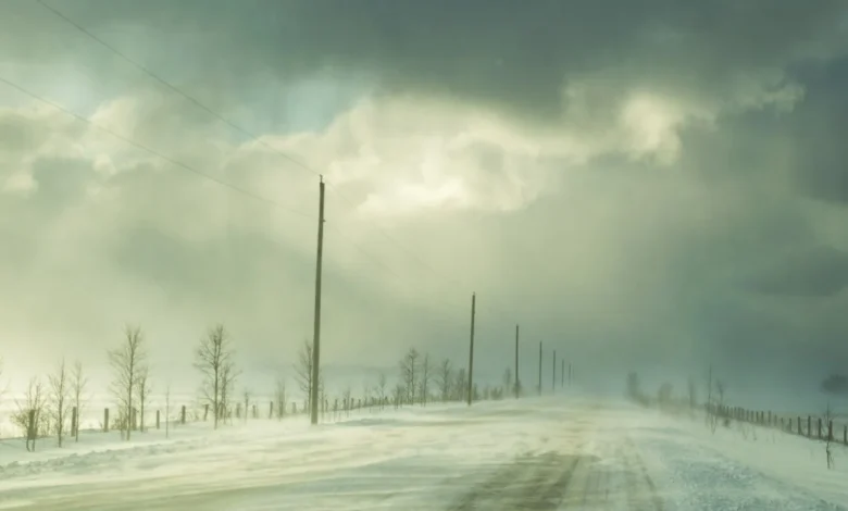
Lake effect snow will be accompanied by northwesterly winds gusting 50 to 60 km/h, Environment Canada says
WEATHER ALERT
ENVIRONMENT CANADA
*************************
Yellow level watch – snow squall – issued for:
- Barrie – Orillia – Midland
- Owen Sound – Blue Mountains – Northern Grey County
- Listowel – Milverton – Northern Perth County
- Stratford – Mitchell – Southern Perth County
- Mount Forest – Arthur – Northern Wellington County
- Innisfil – New Tecumseth – Angus
Impact Level: Moderate
Forecast Confidence: High
Lake effect snow squalls off Lake Huron and Georgian Bay late this evening into Thursday.
What:
Total local snowfall amounts of 15 to 30 cm.
Significantly reduced visibility in heavy snow and local blowing snow.
When:
Late this evening through Thursday afternoon.
Additional information:
Lake effect snow will be accompanied by northwesterly winds gusting 50 to 60 km/h. As a result, blowing snow will further reduce visibility. Conditions are expected to improve by Thursday evening. There is uncertainty with the exact locations of snow squalls that will develop and snowfall accumulations may be quite variable across the region.
Visibility may be suddenly reduced to near zero at times. Road closures are possible.
Prepare for the possibility of quickly changing and deteriorating travel conditions.
Please continue to monitor alerts and forecasts issued by Environment Canada. To report severe weather, send an email to [email protected] or post reports on X using #ONStorm.
*************************