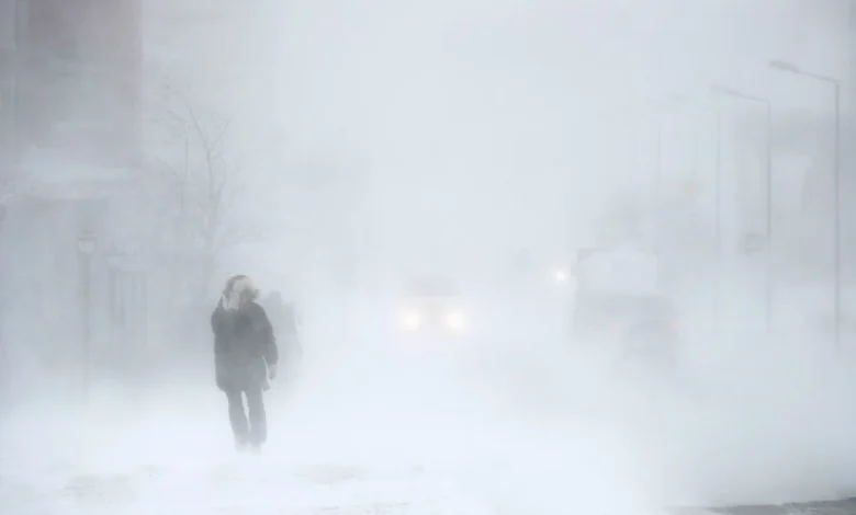
Intense bands of lake effect snow off are expected to develop in the Sault and St. Joseph Island later this afternoon, says Environment Canada
WEATHER ALERT
ENVIRONMENT CANADA
*******************************
Yellow level watch – snow squall – issued for:
Sault Ste. Marie – St. Joseph Island
Impact Level: High
Forecast Confidence: Moderate
Hazardous snow squalls are expected later this afternoon into Thursday.
What:
Hazardous travel conditions.
Near zero visibility at times in heavy snow and local blowing snow.
Total snowfall amounts of 20 to 40 cm.
Intense snowfall rates of 5 to 10 cm per hour at times.
When:
Beginning later this afternoon into Thursday.
Additional information:
Intense bands of lake effect snow off of Lake Superior will develop later this afternoon and continue into Thursday. Strong wind gusts of 40 to 60 km/h will lead to near zero visibility in snow and blowing snow. There remains uncertainty around where the most intense snow squalls set up. Current indications show that the most intense snow may remain to the west of the city affecting the areas near the airport.
Travel may be extremely hazardous. Visibility may be suddenly reduced to near zero at times. Roads and walkways may be very difficult to navigate due to accumulating snow. Road closures are possible.
Prepare for the possibility of quickly changing and deteriorating travel conditions.
Please continue to monitor alerts and forecasts issued by Environment Canada. To report severe weather, send an email to [email protected] or post reports on X using #ONStorm.
For more information about the alerting program, please visit the website.
*******************************