First Week Of Meteorological Winter Will Bring Record Cold To Millions In The Midwest, Northeast
Light Snow Possible For I-95 Cities
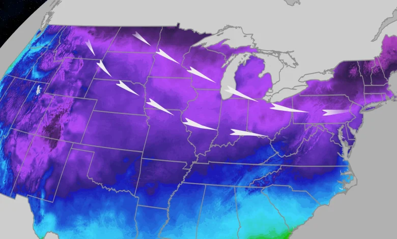
A fresh blast of cold arctic air has sent temperatures plunging below zero in parts of the upper Midwest and could smash daily cold records from the nation’s heartland to the Northeast into Friday.
Notable Cold, So Far
Wednesday, Aberdeen, South Dakota, tied its daily record low of minus 18 degrees.
Thursday morning, temperatures in the teens below zero were reported in parts of Iowa, Minnesota, South Dakota and Wisconsin. Wind chills in the 20s below zero were also reported in some of these same areas.
More Records Could Fall
We could see another dozen or so daily record lows across parts of the Midwest and Northeast Friday morning. Among them include Chicago, Pittsburgh, and both JFK and LaGuardia Airports in New York City.
We may also see record cold daily high temperatures through Friday, primarily in the Midwest, but also a few in the East. Among the cities that could be record cold during the day are Detroit, Milwaukee and Roanoke, Virginia.
Here’s a map where the daily records may fall from Thursday afternoon through Friday.
These are potential forecast daily cold records from Thursday afternoon through Friday, according to National Weather Service forecasts.
Timing The Arctic Blast
Thursday: Afternoon heating won’t help much as temperatures will stay below freezing for millions Thursday afternoon. Temperatures across portions of the Midwest will run 15-25 degrees below average, where some highs won’t rise out of the teens. Even places as far south as Oklahoma City will struggle to make it much above freezing.
Friday: Friday morning the cold dips even farther south and east. Lows in the single digits and teens will be common across the Great Lakes to New England, including the Boston metro. Subzero cold is possible in parts of upstate New York and northern New England.
Lows near 20 degrees are expected in New York City and Philly, and close to freezing (or even sub-freezing) temperatures are expected in the South from northern Texas to Tennessee, North Carolina and Virginia.
The Northeast will struggle to make it much above freezing Friday afternoon. While the Midwest and Plains begin to warm up a tad, temperatures will still only be in the 20s for afternoon highs in most of the Great Lakes and upper Mississippi Valley.
Will There Be Any Snow?
This front will be on the drier side, however, there will be a little snow possible for the extreme northern tier of the country ahead of the cold front for parts of the interior Northeast. That said, this light snow could be in the form of quick bursts known as snow squalls that could lead to sudden, dangerous whiteout conditions.
Parts of the Appalachians, North Carolina and Virginia could also see a quick burst of snow or sleet Thursday night into Friday, mainly south of the Washington, D.C. metro.
But Wait, There’s More Cold On The Way
A second shot of cold air will begin pushing into the Northern Plains and upper Midwest on Saturday. While this front won’t be as cold as the first, it will reinforce those cold temperatures.
By Sunday, parts of the Dakotas and upper Midwest won’t make it out of the single digits or teens for high temperatures.
The colder air will then sweep south and eastward on Monday, plunging temperatures across the Appalachians and I-95 corridor.
Places like Philadelphia, New York and Boston will drop by as much as 10-15 degrees between Sunday and Monday. Their high temperatures for may not make it much above freezing Monday or Tuesday afternoon. Breezy conditions along this stretch of I-95 and the coast, will make temperatures feel even colder.
Lows Tuesday morning could plunge into the teens along much of the I-95 corridor as far south as Baltimore, or even the D.C. suburbs, with subzero cold possible again in upstate New York and northern New England. A few daily record lows could be threatened again in the Northeast.
(MAPS: 10-Day US Forecast Highs/Lows)
Meanwhile, The Plains Will Warm
If you are shivering in the Plains this morning, there is some good news ahead.
Temperatures are forecast to warm up quite a bit early next week. We aren’t talking record warmth, but hopefully a nice change, or break from the cold.
Highs in the 50s could surge as far north as Montana and 60s could briefly return to Denver early next week.
Consider it a brief pause, on the many months left for wintertime cold.
Jennifer Gray is a weather and climate writer for weather.com. She has been covering some of the world’s biggest weather and climate stories for the last two decades.