According to CMOS Accredited Weathercaster Chris Sumner, we can expect somewhere between a “dusting to a few centimeters of snow Thursday” from the second Alberta clipper to roll through the region this week.
“Similar to Tuesday, this system is coming out of northern Alberta, and will quickly dive through Manitoba and continue southeastward into Northwestern Ontario,” he explained. “Along the way, a couple centimeters of snow are possible, but again like earlier this week, that snow will be dry, light and accumulations will be fairly minimal.”
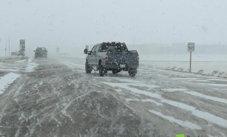
He added, ahead of the low pressure system passing through the area, gusty southerly winds up to 50 km/h could lead to some blowing snow and reduced visibility, depending on whether we see much of the flaky white stuff from the clipper.
For the latest Petro Canada Winkler forecast details, click here.
Sumner noted a third clipper will be right on the heels of Thursday’s system, and that’s bringing the possibility of light snow Friday morning.
“In total, we will have had three Alberta clippers in four days, something we haven’t seen in Southern Manitoba for quite some time,” he said. “By the time they are all through the area, much of the Pembina Valley will have the makings of snowy winter blanket, but certainly a lot of brown ground will be peeking through.”
After Friday’s system leaves, Sumner said it’s a return to well below average temperatures for the weekend.
“Another shot of cold, arctic air pushes southward over the Prairies as surface high pressure descends from the north,” he said. “Daytime highs both Saturday and Sunday will be in the -14 to -16 range, with overnight lows Saturday night deep into the -20s.”
Averages for the start of December are -7 degrees daytime and -16 overnight.
For the latest Sun Valley Tire Road Report and Cancellation information, click here.
Looking ahead to next week, according to Sumner, the forecast models are showing signs of potentially another weak system Monday bringing another round of light snow, and deeper in the week (potentially Tuesday night into Wednesday) perhaps a stronger system that could be a more significant snow maker.
“With that said, that second system’s track is landing over a fairly wide range in the models, so uncertainty regarding impacts remains high,” he said. “We’ll keep an eye on that one, though, especially with lots of us out and about for Christmas concerts, shopping and family gatherings.”