Up to 3 inches of snow could fall across parts of Texas from Wednesday night into Thursday.
The Texas Panhandle and nearby areas are preparing for winter weather as multiple alerts from the National Weather Service (NWS) signal potential disruptions from Wednesday into Thursday. The forecast warns of hazardous travel conditions, cold temperatures, and the possibility of localized snow accumulation that may impact daily life in affected regions.
Although it’s not unusual for the Amarillo area to see snowfall this time of year, NWS meteorologist Luigi Meccariello told Newsweek, it is the first snow event of the season.
The NWS has issued a series of special weather statements and hazardous weather outlooks highlighting the arrival of winter conditions for parts of the Texas and Oklahoma Panhandles, including cities such as Amarillo, Dalhart, and Hereford.
A weather system is projected to enter the area Wednesday afternoon, accompanied by a strong cold front pushing temperatures to the upper teens and low 20s in some locations. According to the NWS statement issued from Amarillo, the period with the highest risk for snow accumulation extends from Wednesday afternoon through Thursday morning.
“It’s anticipated that this system will produce some snow bands, possibly a narrow area of snow,” NWS Amarillo said in a special weather statement. “These band locations could range from the Oklahoma Panhandle down to the southern Texas Panhandle. Right now there`s high uncertainty on the location of the snow bands, so much that winter highlights are currently on hold. As the system approaches and we narrow down the areas that have the greatest chances of impactful accumulating snow, then we’ll add winter highlights as needed.”
The NWS has forecast “about a 30 to 60 percent chance of receiving at least an inch of snow between Wednesday afternoon, and Thursday evening” for affected counties.
“If these turn out to be narrow snow bands, then there could be several areas that receive little to no snow, while more isolated areas pick up 1 to 2 inches of snow,” the special weather statement said. “And those same areas would have about a 10 percent chance of greater than 2 inches of snow.”
Further south, the NWS office in Lubbock, Texas, warned of a chance for “light snow from this evening through Thursday morning across the far southwest Texas Panhandle and northern South Plains.”
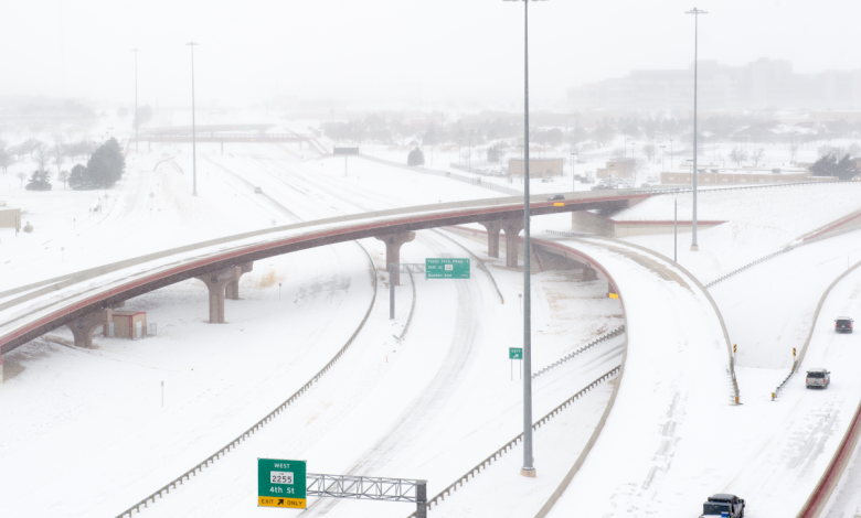
Forecast impacts include hazardous travel, especially overnight and early Thursday morning due to slick spots, particularly on bridges, overpasses, and untreated roads.
The National Weather Service urges residents to monitor official forecasts for updates as the location and intensity of snow bands remain uncertain. Travelers and locals are advised to exercise caution, particularly during impacted hours.
Snow showers and wintry conditions are likely to ease after Thursday morning, according to the forecast.