Early winter in Toronto? Here’s what’s causing the freezing temperatures, and how long it will last
What to know
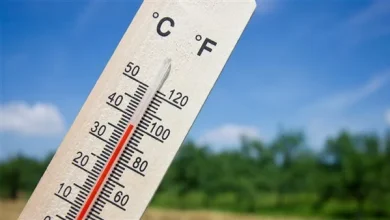
- Temperatures in Toronto are sitting 5 to 10 degrees below average as an Arctic air mass moves into Southern Ontario, bringing wind chills near –18°C.
- An Environment Canada meteorologist says the city will see a pattern of freezing days followed by mild breaks, with December expected to remain colder than normal overall.
- A snow squall alert is in effect for regions north of the GTA, with blowing snow and up to 20 cm expected in affected areas.
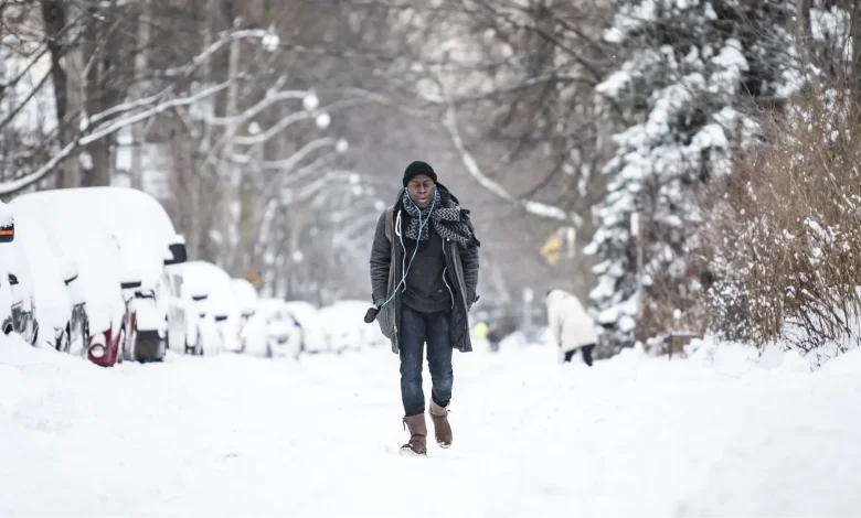
It’s not officially winter yet, but Torontonians woke up to freezing temperatures this morning and can expect fluctuating temperatures in the coming week, according to Environment Canada.
Today, temperatures are expected to reach a high of only -4 C, and a freezing low of -10 C a according to Environment Canada. Windy conditions will make the weather feel even colder, with windgusts reaching up to 40 km/h, making temperatures feel near -16 C this afternoon and -18 C overnight. There is also a chance of flurries this afternoon, as the city could see 2 to 4 cm of snowfall.
Read More
Steven Flisfeder, a meteorologist at Environment Canada, tells Now Toronto that these temperatures are between five to 10 degrees below the average for this time of the year for the GTA. The significantly colder weather comes as an arctic air mass makes its way across Canada.
“That very cold air mass, which originates in the Arctic, has been migrating south towards Southern Ontario over the past couple of days, bringing these temperatures cooler than they ordinarily would be,” he said on Thursday.
Last month, meteorologists warned that a rare polar vortex phenomenon would be bringing some of the coldest air on Earth down to Canada, bringing cold temperatures in December that could last through the month.
Read More
Following freezing temperatures today and tomorrow, Flisfeder says temperatures could reach more mild levels on the weekend, followed by another cold front late Sunday into Monday. This fluctuating trend could continue at least into next week.
“We’re going to be seeing these waves of very cold followed by moderate and as of now, we’re expecting that to continue for at least the next week, possibly longer. And generally speaking, we’re expecting December to be cooler than normal, on average,” he said.
According to the meteorologist, these cold temperatures could also bring risks of frostbite, for those spending extended periods outside and without proper winter wear, recommending that Torontonians avoid going outside if possible, and dust off their gloves, boots and winter jackets.
“If you do have to spend time outdoors, make sure you’re wearing the proper clothing so all exposed skin is covered as much as possible. So, hats, scarves, gloves, jackets and wearing layers is a good way to help with that as well, especially on windy days, [because] the wind pulls that warmth that your body produces away from the body, which is what can cause that frostbite risk,” he added.
SNOW SQUALL WARNING
On top of the cold front, Environment Canada has issued a yellow-coloured snow squall alert, which will affect parts of the Greater Toronto Area (GTA).
Read More
Lake-effect snow squalls could hit parts of Ontario today, affecting regions off Lake Huron and Georgian Bay this morning, bringing 10 to 20 cm of snow to the area, with accumulations possible north of the province, from Newmarket to Uxbridge to Port Perry.
Windgusts between 50 to 60 km/h could also result in blowing snow, which can reduce visibility in the region and affect travel plans.
Flisfeder says that although the event will be mostly concentrated in northern Ontario, there is a chance some snow could make its way into the GTA, although there are currently no warnings for the region.
“Those snow squalls are expected to last through most of the day. Some of that snow could make its way farther south towards Toronto, but it’s not expected to be significant amounts, and so the alerts are not in place for southern portions of the GTA closer to Lake Ontario.”
FREEZING CONDITIONS CONTINUING THROUGH NEXT WEEK
Torontonians can expect freezing temperatures to continue through Friday, with a high of -1 C and a low of -2 C at night, and windgusts up to 40 km/h making it feel like -14 C in the morning and -6 C in the afternoon.
The cold front is expected to slow down during the weekend, with temperatures reaching a high of 1 C and low of -5 C on Saturday, and a high of -1 C on Sunday. Also on Sunday, a new wave of cold weather will make a comeback into the city, reaching a low of -9 C.