N.J. weather: Light snow, freezing drizzle in forecast for parts of state today. Latest updates.
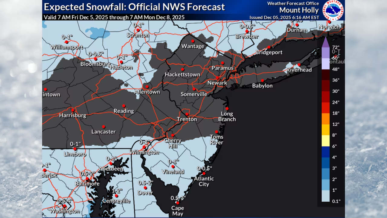
Light snow with accumulations of up to 1 inch could fall in parts of southern New Jersey on Friday while the rest of the state is gripped by bitter cold temperatures.
The National Weather Service reports that single-digit temperatures and low teens are occurring across parts of northern New Jersey on Friday morning.
Temperatures will only reach the upper 20s to upper 30s Friday afternoon, with lower 40s possible along the Jersey Shore.
Parts of New Jersey could see up to an inch of snow during the day Friday along with some freezing drizzle this evening as a cold airmass blankets the state.AccuWeather.com and National Weather Service
“It is a very chilly morning across the area,” the National Weather Service said early Friday.
For South Jersey, “watch out for light snow moving in through the morning,” the weather service said. “Accumulations are expected to be light – generally near or below one inch. For the rest of the region, some very light rain/snow could move in later today, but no significant accumulations are expected further north.”
Parts of New Jersey could see up to an inch of snow during the day Friday along with some freezing drizzle this evening as a cold airmass blankets the state.AccuWeather.com and National Weather Service
Pockets of drizzle or freezing drizzle, particularly along and southeast of the Interstate 95 corridor, are possible Friday night.
Temperatures will fall into the mid 20s to low 30s overnight.
Saturday will see high temperatures climbing to around 40 degrees.
Sunday brings similar temperatures in the upper 30s to low 40s under mostly dry conditions, though a strong cold front approaching late Sunday night may produce scattered snow showers, mainly across northern areas.
Parts of New Jersey could see up to an inch of snow during the day Friday along with some freezing drizzle this evening as a cold airmass blankets the state.AccuWeather.com and National Weather Service
Some of the coldest air of the season arrives early next week behind Sunday night’s front.
High temperatures Monday and Tuesday will likely remain in the upper 20s and 30s region-wide, with gusty northwest winds adding to the cold feel.
Morning wind chills Tuesday could fall into the single digits across inland areas and teens along the Jersey Shore.
Another weather system may move through the region Wednesday, bringing the next chance for precipitation, with potentially another system possible later in the week.
Forecasters note considerable uncertainty remains regarding the timing and impacts of these mid-week systems.