The run up to Christmas could be a white one for some Brits as a cold snap begins to grip the nation – some parts of the country will face freezing conditions and heavy winds
Snow could be on the way tonight(Image: PA)
Ten towns across the country could be preparing for blankets of snow as weather maps turn an icy white.
Commuters this evening have been warned to “take more time” as a bitter cold front causes temperatures to plummet and strong winds to pick up in another part of the country. With Christmas drawing nearer, weather maps from WXCharts, using MetDesk data, have revealed the ten locations could see snowfall on Friday. Although not all Brits will see flurries of snow fall this evening, the cold blast will bring cold temperatures and more dreary conditions across the nation.
The weather maps have revealed that Stoke-on-Trent, Crewe, Macclesfield, Sheffield, Carlisle, Dumfries, Hawick, Ayr, Stirling and Perth are the areas most likely to be hit by a sprinkling of snow around 6pm today.
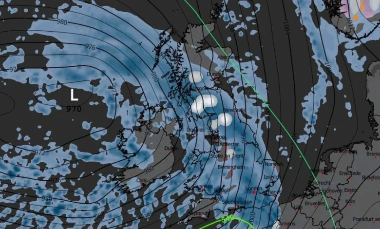
A weather map showing snow in the UK on Friday(Image: WXCharts)READ MORE: Met Office gives verdict on how much snow needs to fall to declare white ChristmasREAD MORE: Met Office tells Brits in 4 areas to prepare for flight delays and cancellations
At the same time, weather experts are forecasting a more miserable picture for much of the rest of the nation, with downpours expected everywhere apart from regions along Northern Ireland’s border with the Republic, the Highlands and South West.
Around 3am on Saturday, most of the wet weather will have swept across England, with some remaining in Wales and the Scottish Highlands. Snow is also forecast to hit areas just south of Inverness and throughout the central Highlands during this time.
The north of England and Scotland will not be the only places facing harsh weather conditions on Friday. The Met Office has put out a yellow wind warning covering all of Northern Ireland. The agency said people can expect a spell of strong and gusty winds “bringing potential disruption to transport and infrastructure”. This warning is in place until 7pm this evening.
The Met Office said: “A spell of strong southeasterly winds will push from southwest to northeast across Northern Ireland through the afternoon, clearing the north coast this evening. Winds will widely gust 45-55 mph, with gusts to 60 mph possible for exposed coasts of counties Down and Antrim, as well as over and to the lee of high ground elsewhere. As well as strong winds, a period of persistent rain will also affect all areas for a time, making for difficult travelling conditions.”
Chief Meteorologist Matthew Lehnert said: “The UK will see further unsettled weather through the weekend and into next week.”
The Met Office also issued a warning that a stormy spell of weather could hit next week, with particularly wet conditions forecast for Monday and Tuesday.
Deputy Chief Meteorologist Steven Keates said: “A deep area of low pressure will approach the UK from the southwest later on Monday, bringing with it heavy rain and strong winds. While it’s still uncertain exactly where the strongest gusts and heaviest rain will hit, there is potential for the weather to cause some disruption.
“People should stay updated with the forecast throughout the weekend, and keep an eye out for severe weather warnings that may be issued for this area of low pressure.”