ORLANDO, Fla. – The FOX 35 Storm Team has issued a FOX 35 Storm Team Alert for Sunday night and the overnight hours into Monday due to strong showers and thunderstorms, heavy rainfall, and the slight chance of a tornado warning.
These showers and storms could bring damaging winds and produce torrential rain, leading to some localized flooding in some areas.
Headed to the airport? The weather is causing some significant delays at Orlando International Airport and Tampa International Airport, according to the FAA. Flights to – and from – Orlando airport were delayed an average of two hours due to the showers and thunderstorms.
Timeline: When will the storms arrive? When could we see the heaviest rainfall?
Showers and thunderstorms will stick around through the afternoon, evening, and overnight hours throughout Orlando and across Central Florida.
The worst weather is expected to last through 2 a.m. Monday.
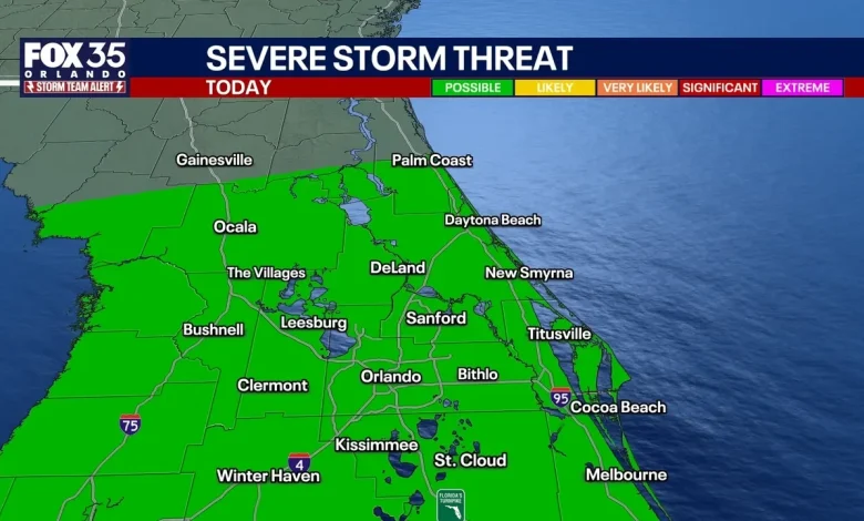
The most intense rain is likely to cross Gainesville and Ocala and eastward towards Daytona Beach. Areas in Orlando along I-4, we’ll see storms through the evening, but rain and storms will continue through the rest of the overnight tonight, leading to the possibility of some flooding.
Brevard County, especially in areas across southern Brevard County, will continue to see a possible risk of severe weather until the early morning hours of Monday.
Weather impacts: What are the biggest threats?
Strong and damaging winds and torrential rain, leading to the potential of localized flooding, are the main weather threats from these storms.
However, there is a chance for a brief tornado warning/tornado into the evening and overnight hours. The risk is considered to be low, but the chance is there.
Rainfall totals: How much rain will we get in Orlando, Central Florida?
Flood advisories have been issued for parts of Brevard, Lake, and Orange Counties from these showers and thunderstorms. More than 2″ of rain has fallen in these areas with an additional 1.5″-2″ of rain possible.
Some areas – spanning Tampa and Lakeland to Orlando and Lake Buena Vista to the coast – could see up to 4″ of rain in spots, according to forecast models.
Tornado threat: When and where?
Along the leading edge of the front, there is enough wind energy that could result in a very brief tornado. This is over Orlando through the rest of the evening into the overnight hours.
This moves into Brevard County as we head into the early morning hours of Monday.
Monday Forecast: When does the rain end?
The FOX 35 Storm Team has issued an alert for the rest of the overnight tonight into tomorrow morning. This will impact the early morning commute and make road slick as traffic really picks up tomorrow. Showers and storm should to taper off by 9–10 AM.
The Source: The information is from the FOX 35 Storm Team and the National Weather Service.
Severe Weather