Published on Dec. 9, 2025, 1:10 PM
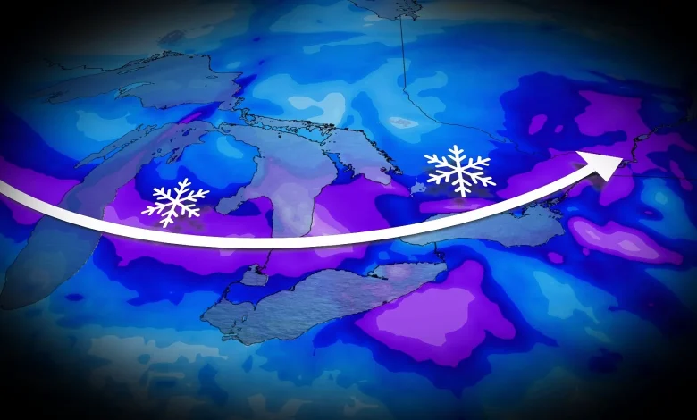
Two clipper systems will bring 5-15+ cm of snow across parts of Ontario mid-week, with some lake-effect snow filling in behind
Wintry conditions persist in Ontario this December, with frigid temperatures, and several rounds of snow in the forecast this week. Some areas could receive another 5-15+ cm of snow ahead of winter’s official start.
RELATED: Toronto braces for coldest temperatures in nine months
Light snowfall is expected Tuesday from the first system, with heavier snow set to develop overnight into Wednesday with the second system. Behind these pair of clipper systems will be another round of lake-effect snow targeting communities southeast of Lake Huron and Georgian Bay lat week.
Be sure to monitor the forecast for updates regarding snowfall amounts and impacts, as well as any alerts as conditions change or deteriorate.
Two clipper systems to bring another healthy swath of snow into Wednesday
The week began with a midwinter-like chill, bringing the coldest daytime highs in more than nine months to places like Toronto and Ottawa. Temperatures remain well below seasonal for most areas.
A clipper from the Prairies will bring a quick burst of snow Tuesday across central and southern Ontario. A general 2-5 cm is expected throughout the day, with blustery winds causing some blowing snow into the evening.
A second clipper arrives Tuesday night, carrying Pacific moisture, which will increase snowfall amounts and introduce slightly milder air.