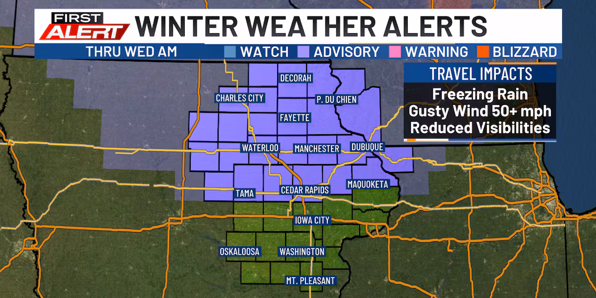
CEDAR RAPIDS, Iowa (KCRG) – After a milder afternoon, travel impacts head our way. A First Alert Day is in effect his evening through Wednesday morning.
First Alert Day(kcrg)
Freezing rain/drizzle is possible during this evening, mainly along and north of Highway 30, so use extra caution if you’re traveling.
Severe Weather Alerts
(KCRG)
Overnight into Wednesday morning, snow showers and possible snow squalls are expected to move in with a strong cold front. Expect very windy conditions tonight and Wednesday with gusts potentially reaching over 50 miles per hour.
Wind Forecast(kcrg)
Our unsettled pattern continues through the weekend with additional snow expected Thursday through Sunday. Temperatures will plummet, and by Friday and Saturday nights, wind chills will drop well below zero.
Weekend Snow Chance(kcrg)
Copyright 2025 KCRG. All rights reserved.