- 12-12-2025
- National
- Canarian Weekly
- Photo Credit: CW Stock Image
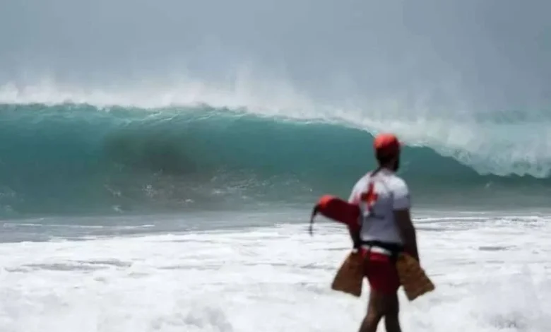
Storm Emilia is forecast to generate extremely dangerous sea conditions across the Canary Islands, prompting authorities to activate coastal warnings for the entire archipelago. Conditions are expected to deteriorate significantly from around midday today, Friday, with the most hazardous period forecast for this evening and overnight.
Meteorological forecasts indicate force 6 to 7 winds, with localised force 8 winds (sustained winds, not gusts) between La Gomera and Tenerife, particularly affecting the maritime channel between the two islands, meaning any boat trips and water sports will be cancelled, as these wind conditions will drive powerful swells towards coastlines.
By tonight, before midnight, the significant wave height along north and west-facing coasts is expected to reach 4 to 4.5 metres. However, experts warn that individual waves could reach heights of up to 13 metres, posing a serious and potentially fatal risk to anyone near the sea.
High tide is expected between 7.35pm and 8.15pm, coinciding with the worst sea conditions. During this period, waves may come over coastal defences, flood promenades and sweep across rocks and natural pools without warning.
Authorities plead for people to respect coastal warnings
Authorities are once again stressing the critical importance of respecting coastal warnings, particularly following recent death of 8 people linked to rough seas in the Canary Islands. Ignoring alerts and approaching the coastline during severe weather has proven to be extremely dangerous.
Residents and visitors are strongly advised to stay well away from coastal promenades, cliffs, natural swimming pools, rocks and breakwaters, even if conditions appear calm at times. Emergency services remind the public that the ocean can change suddenly and violently, and that no photograph or video is worth the risk to life.