INDIANAPOLIS (WISH) — Prepare for an impactful weekend system that brings a one-two punch of accumulating snow and brutal cold.
Once Indiana gets past this weekend, Hoosiers can begin to celebrate much warmer times ahead into next week.
Winter Weather Advisories will be in effect from 11 a.m. to midnight Saturday. Areas in southeastern Indiana will be under Winter Storm Warnings from 1 p.m. Saturday to 7 a.m. Sunday.
Then, Cold Weather Advisories will be in effect Sunday morning due to the expectation of dangerous wind chills.
Friday night: Potential for spotty snow showers and mostly cloudy with lows in the low to mid 20s.
Saturday: A few snow showers may sneak through the area in the morning before the main part of system slides in. Widespread snow will get into the state closer to mid- to late morning and approach the Indianapolis metro near or just after the lunch hour. Some heavier snow rates are possible, and this will be a more fluffy wet type of snow. Snow looks to wind down into Saturday night, but expect heightened travel impacts.
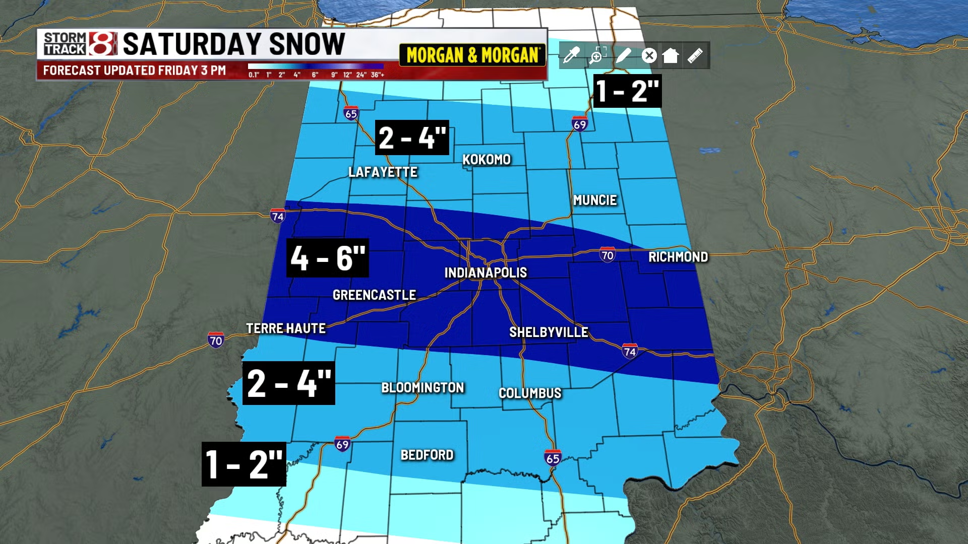
Across central Indiana, we’re forecasting 2-6 inches of snow with a more narrow band of 4-6 inches in central Indiana.
Highs in the low 20s. Wind chill values through Saturday night will turn subzero.
Sunday: Brutal cold will take shape, with the possibility of record cold low and high temperatures for the day. For starters, Sunday morning’s lows will be near to below zero with dangerous wind chills of -10 to -20. The record cold low for Indianapolis on Dec. 14 is -4 from 1901. Sunday afternoon will see numbers barely get into the teens for some locations. Indy’s record cold high for Dec. 14 is 9 from 1963. It is also worth mentioning that some areas will likely have subzero wind chills all day.
7-Day Forecast: Monday morning will be as equally brutal temperature-wise with near to below-zero lows, and wind chills from -10 to -15. However, we look to take a track back into the 20s Monday afternoon. Then, the relief can finally settle in with those searching for a break from the cold as highs look to warm all the way near 50 degrees by next Thursday. There will be some rain chances around next Thursday as well, but at least we will get to turn the bitter cold away from us into mid to late next week.


