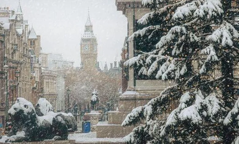
Britain could be set for a White Christmas with weather maps indicating snow may sweep further south than anticipated, potentially reaching London on Christmas Day itself
Matt Lloyd, Emily Wright and Liam Doyle
09:07, 13 Dec 2025
(Image: Getty)
Britain appears poised for a proper White Christmas this year, with the most recent weather maps suggesting snow could travel much further south than expected – possibly even hitting London on Christmas Day itself.
Fresh charts from WXCharts, displaying conditions at midday on December 25, show extensive wintry showers covering the UK, with snow forecast from Scotland all the way down to the Home Counties.
While northern areas are used to festive snowfall, the latest modelling suggests considerably colder air penetrating deeper into England, boosting the chances of a seasonal dusting in the capital.
Read More: Marks & Spencer’s ‘pot of joy’ light-up candle is now £12 as fan says ‘I bought seven’
The maps show a mix of light to moderate snowfall across central and northern parts of the nation, with heavier deposits anticipated over Scotland’s higher ground.
Significantly, the “528 line” on the chart – a crucial meteorological indicator used to gauge snow probability – stretches well into southern England.
This reinforces the prediction for borderline yet possible snowfall across the southeast, especially during shower periods.
The 528 line serves as a vital reference point for weather forecasters when predicting wintry weather – areas situated north of this boundary are likely to experience precipitation as snow, whilst those to the south are more susceptible to rainfall.
Help a child in poverty this Christmas
Thousands of children from the West Midlands will wake up on Christmas day with no gifts – but there’s something you can do about it through our Brumwish Christmas campaign.
Order something from this Amazon wishlist and, working with Thrive Together Birmingham and Edgbaston Stadium, we will deliver direct to a poor or homeless child living in the area in time for Christmas day.
Birmingham Mail and Birmingham Live Grant a Christmas #Brumwish
A distinct “Minimum Temperature” WXChart map for Christmas Day shows chilly air blanketing northern and central regions of the UK, with temperatures dropping close to freezing throughout Scotland, northern England and sections of Northern Ireland, reports the Mirror.
The chart displays zones of 0-2C stretching from Aberdeen and Dundee southwards to Newcastle and the Pennines, whilst slightly warmer yet still crisp conditions of 4-7C are forecast further south.
Should these forecasts prove accurate, much of Britain could awaken to snow flurries or at minimum the possibility of snow showers, with Scotland, northern England and Ireland facing the greatest likelihood.
For London and the Midlands, conditions may depend on shower timing and how dramatically temperatures plummet on Christmas morning.
Whilst the earlier chart indicates widespread snow showers, a snow-depth forecast offers a more precise outlook of where accumulation might occur.
Based on this mapping, settled snow on Christmas Day appears mainly restricted to the Scottish Highlands, with depths of 2cm to 6cm projected around Inverness, Aviemore and elevated areas west of Dundee.
Weather maps suggest a White Christmas could be on the cards(Image: WXCharts)
The Met Office’s extended forecast covering December 16 to December 25 indicates: “Unsettled at first with spells of rain affecting the UK at times.
“Some heavy rain is possible anywhere, but it is likely to be heaviest and most persistent in the west and northwest, with sheltered parts of the east and southeast typically drier.
“Any snow will probably be confined to high ground in the north.
“Strong winds are possible at times with a risk of gales, especially along coasts and over higher ground.
“Temperatures are likely to be above normal overall.
“Later in the period, conditions may start to become a little more settled, with rainfall amounts decreasing and drier weather becoming more prevalent, especially in the south.
“This may mean an increasing amount of overnight fog and frost.”
The Met Office regularly emphasises that forecasting snowfall remains difficult, particularly well in advance, as slight changes in temperature, wind direction or the boundary between rain and snow can dramatically affect where winter weather materialises.