CLEVELAND, Ohio (WOIO) – A much colder air mass is in place today. Another cold front tracks through Saturday night.
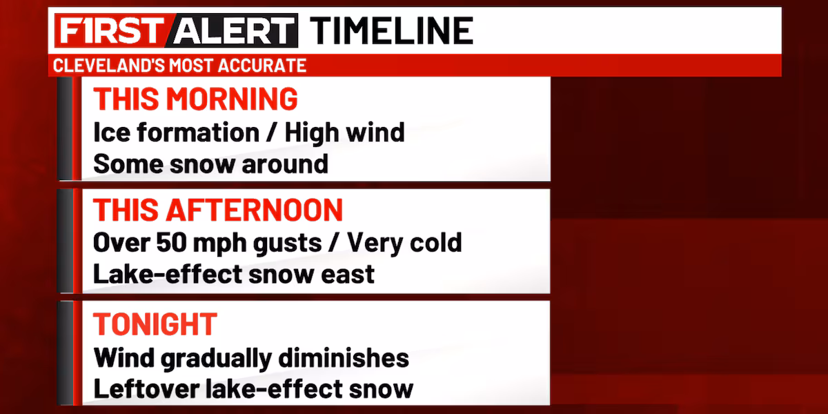
Wind will be a big deal today as a rush of much colder air continues to build in this morning. West winds could gust over 50 mph at times. The sharp drop in temperatures is turning the wet ground to ice. This could make travel very treacherous through the day. Afternoon temperatures in the lower to middle 20s. Lake-effect snow will be in the area off Lake Michigan and Lake Erie. The primary snowbelt east of Cleveland could receive locally over 7 inches of snowfall in squalls. It’ll be 1 inch or less elsewhere.
The wind will gradually diminish tonight. Some flurries around. Leftover lake-effect snow east of Cleveland. Locally over 2 inches of additional snow is possible. Early morning temperatures tomorrow around 20 degrees.
A warmer and windy day tomorrow. South winds could gust over 35 mph at times. Mostly cloudy with late afternoon temperatures in the 40s.
Colder and windy Sunday. West to northwest winds could gust over 35 mph at times. Some lake-effect snow showers around with 1 inch or less of snowfall. Steady temperatures forecast in the middle to upper 20s.
Copyright 2025 WOIO. All rights reserved.