Everyone wants to know if it will be a whiteout for Christmas with a change in the weather pattern being predicted
16:02, 18 Dec 2025
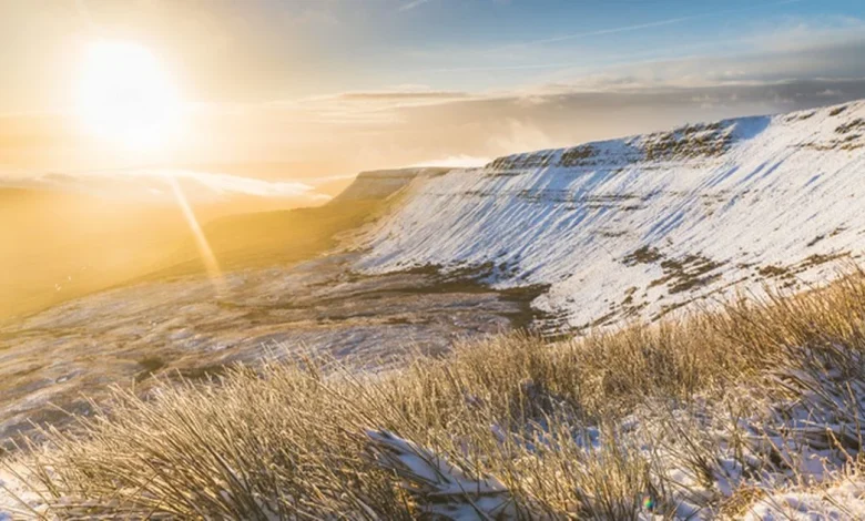
A wintry landscape at sunrise in Wales, where temperatures dropped to -5°C last night(Image: Getty Images)
With one week left to go the Met Office has issued its long-range forecast for Christmas Day. While it is still a little early to say for certain, the forecasting agency says that current trends point towards a shift in our weather pattern as we move through the weekend and into Christmas week.
They say that after a spell of unsettled, wet, and windy conditions, high pressure looks set to build – bringing quieter, drier, and somewhat cooler weather for many.
Before then it will remain unsettled with a waving front approaching from the southwest set to bring another spell of heavy rain and blustery winds through Thursday.
The wettest weather is expected across southern England and south Wales, where rainfall totals could reach 40 to 50mms and possibly higher over high ground in the southwest.
Winds will also strengthen with gusts widely between 40 and 50mph and potentially 60 to 70mph in more exposed coastal areas of the southwest. Yellow weather warnings for rain are in place across much of southern England and Wales.
The forecasters say that after this band of rain clears, showers will follow before conditions turn somewhat drier through Thursday night. By Friday a brief respite from the unsettled weather looks likely.
Many areas can expect a largely dry day with some sunshine, although showers will linger across northern and western parts. Temperatures will dip slightly compared to Thursday, and the day will feel more pleasant with lighter winds and a few brighter spells.
The weekend begins with another front approaching from the west on Saturday. This narrow band of rain will push eastwards but may struggle to make much progress across the country.
The heaviest and most persistent rain will be across western parts of the UK, where strong winds are also likely. A few heavier bursts and even some isolated rumbles of thunder are possible along the frontal boundary.
For most areas rainfall totals will not be particularly high, but given that ground conditions are already saturated after recent downpours, even modest rainfall could exacerbate existing flooding issues.
Western and southwestern areas could see cumulative totals reaching 100 to 150 millimetres by the end of the weekend. With that in mind, it will be important to stay aware of any flood warnings that may be issued over the coming days.
Sunday looks more mixed with outbreaks of rain gradually weakening and edging back westwards. Many eastern parts should see a drier and brighter day with lighter winds and temperatures close to seasonal averages.
As we head into Monday, December 22, the Met Office says the “weather pattern begins to shift”. It adds: “The unsettled westerly regime that has dominated much of the month gives way to a more stable setup as high pressure begins to build from the north and northeast.
“Initially low pressure remains nearby but confidence is growing that this high will become increasingly dominant through the early part of next week.”
By Tuesday and Christmas Eve there is around a 50 to 60% chance that high pressure will be centred just to the north of the UK, bringing a marked change in conditions.
The agency says: “This setup would lead to a much quieter spell of weather, with drier conditions for most areas. The exact position of the high will determine local details, but the general theme is one of stability after a turbulent start to December.”
It adds: “For Christmas Eve and Christmas Day the most likely outcome is that high pressure remains close to or just north of the UK. This would bring largely settled weather, with light winds, dry conditions, and perhaps some sunshine by day. However, the air circulating around the high will come from the east – and at this time of year, that often means colder air.”
Currently temperatures across much of Europe are not as low as they might typically be at this point in winter, so while an easterly breeze will introduce chillier conditions, it is not expected to deliver a sharp drop in temperature.
Most places will see daytime highs a few degrees below average, with maxima generally around 5 to 7°C. Overnight frosts will become more frequent, especially in rural areas, and some mist and fog patches are likely to form.
The forecasters say: “While it’s too early to say with certainty, a few wintry showers may develop around some eastern coasts during the Christmas period.
“Any snow that does fall looks likely to be light and patchy with no sign at present of anything widespread or disruptive. Technically only one snowflake recorded anywhere in the UK is needed for it to be a ‘white Christmas’, so it remains a possibility, albeit a slim one this year.”
High pressure is expected to remain in control through Boxing Day, keeping the weather largely dry and settled. As the easterly flow continues, temperatures may fall a little further, particularly if the high remains to the north of the UK and draws in air from further east.
This would bring a more noticeable chill, especially to eastern and central areas, while western parts may remain a touch milder under thicker cloud.
Summing up, the agency says: “The main weather-related impacts over the festive period are likely to come from the return of overnight frost, the potential for icy patches on untreated surfaces, and some lingering fog that could affect travel. For many, however, it looks like a welcome spell of calmer weather after a particularly unsettled start to December.”