Published on Oct. 28, 2025, 12:15 AM
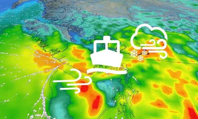
A vigorous low approaching the B.C. coast on Tuesday will generate intense, possibly damaging winds and waves, alongside heavy alpine snow for the mountain passes. Ferry interruptions and difficult travel are possible
B.C. can expect more stormy weather this week as an active pattern sticks around, with unsettled conditions anticipated in the days up to and on Halloween, too–and beyond.
A powerful Pacific storm will track in on Tuesday, with wind warnings in effect for the coast ahead of its arrival. Widespread, heavy rain will develop across the South Coast. Alpine snow will impact travel through the higher mountain passes as heavy amounts are expected.
DON’T MISS: Blue jays love to steal paint chips off houses. Here’s why
In addition to the snow and rain, potent wind gusts will be an issue with the incoming system on Tuesday. With gusts of 70-100+ km/h in some areas, expect difficult travel on the mountain passes and possible ferry delays and/or cancellations.
There will be some breaks between systems, but it looks like a potent and soggy storm, possibly an atmospheric river, will impact the region for Halloween. The wet pattern will continue into the early days of November, as well.
Heavy mountain snow, rain, blustery winds teeing up on the B.C. coast for Tuesday
Don’t put away the rain gear just yet. Another storm system will approach the coast on Tuesday.
A new wave of strong winds hits the northern and central coasts by early Tuesday afternoon. Coastal sections could see gusts exceeding 100 km/h.