We’re a little chillier to start today, as temperatures this Halloween morning start out in the upper 30s and low 40s. Mostly cloudy skies this morning will stick around for most of the day. Temperatures hold pretty steady in the low 40s through lunchtime. This afternoon will bring our high temperature back into the mid and upper 40s, as gusty winds blow from the west.
Mostly cloudy skies settle in this morning.(maxuser | WVVA WEATHER)
A Wind Advisory is in effect for western Greenbrier and northwestern Pocahontas counties until 5 PM today. Sustained winds of 15-25 mph will be possible, with wind gusts of up to 45 mph. These gusty winds will blow around unsecured objects. Tree limbs could be blown down and a few power outages may result. Winds this strong could also make driving difficult for high profile vehicles.
We’ll see wind gusts across all of our area, not just in those spots. The strongest gusts will start around lunchtime and continue until sunset. After that, we’ll see winds gradually die down overnight, staying a little breezy for trick-or-treating.
Gusty conditions will be possible in our upper elevations.(maxuser | WVVA WEATHER)
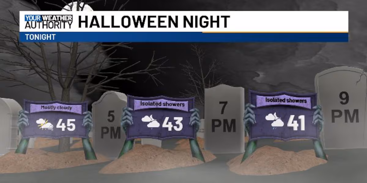
As we head out for trick-or-treating tonight, a few isolated showers will be possible. These will be very hit or miss, and most of us won’t even see rain. Temperatures will be falling through the low 40s.
Temperatures fall into the low 40s, with a stray shower possible.(maxuser | WVVA WEATHER)
The isolated showers will be possible starting around 6 PM tonight, continuing through 9 PM. After midnight we’re going to see mostly cloudy skies into Saturday morning. Saturday itself is looking mainly cloudy, but a little bit warmer, as temperatures reach up into the low to mid 50s. Sunday will bring a similar vibe, but with the added chance of a few showers to the west.
Temperatures warm up slightly into the weekend.(maxuser | WVVA WEATHER)
Temperatures all week long have been cold but starting next week we’ll be closer to seasonable levels, with highs reaching up into the mid and upper 50s. Next week looks dry, with a lot more sunshine than what we saw this week.
Copyright 2025 WVVA. All rights reserved.