ROCKFORD, Ill. (WIFR) – The start to our November has been nothing short of fantastic. Temperatures have been in the upper 50s to lower 60s making it great to be outside. However, there is a major shift coming this weekend that could bring some frigid temperatures and our first potential snowfall of the season.
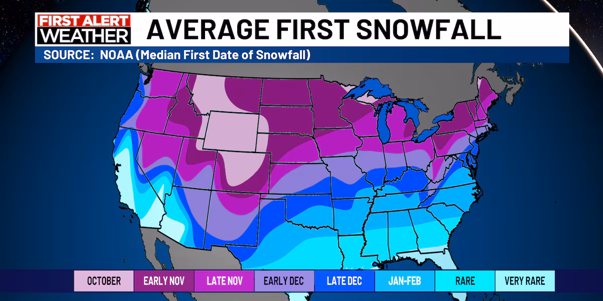
Historical snowfall data from the past 30 years
On average, our first flakes fall around November 21. However, this weekend wouldn’t be the earliest. On Oct. 29, 2019, half an inch of snow fell in the Forest City.
The latest first snowfall came in 2012, when 1.4 inches of snow blanketed Rockford on December 20.
Typically, our first snowfall only gets a few tenths of an inch with our median amount being 0.3 inches. However, we have had some big snowfalls, like the one on December 6, 1994, when 6.9 inches fell.
What we’re expecting this weekend
This weekend’s snowfall likely won’t be anywhere close to seven inches. Instead, we’ll likely only get a trace or a tenth of an inch, if any snow ends up falling.
An upper level low pressure system will move overhead Saturday with the main disturbance and moisture moving overhead late Saturday evening into Saturday night. Winds will be out of the north, drawing from a frigid pocket of air, allowing temperatures to steadily drop into the middle to lower 30s around midnight and the mid-20s by Sunday morning.
This will help transition some of the rain that we’ll get late Saturday afternoon into a wintry mix and even just pure snowfall by early Sunday.
Luckily, our ground is way to warm for anything to stick, so the only impacts we’ll have to deal with Sunday is the cold.
Copyright 2025 WIFR. All rights reserved.