CHICAGO – An incoming storm system will bring rain to the area late tonight into early morning Friday.
Most areas can expect around a quarter inch or less of rain before drying out around daybreak tomorrow.
Full forecast :
Most of Friday looks nice with mostly sunny to partly cloudy skies and highs in the lower 60s.
Winds will pick up during the day and gust to around 30 mph out of the west. Soak up the warmth while it’s here! Temperatures will take a big dive this weekend.
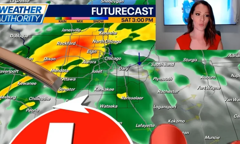
Temperatures on Saturday will top out in the upper 40s to near 50 degrees with rain moving in by late morning or midday. Rain showers are expected through the afternoon and into the evening, and as temperatures drop in the evening, this rain may transition to snow.
Accumulations will be little to none, but grassy and elevated surfaces may see minor slushy accumulations.
Temperatures turn sharply colder on Sunday and Monday with highs only in the 30s. Lake effect snow showers are possible both days, although the placement and timing of these snow bands are still uncertain. As of now, it appears like most of the activity will be in Northwest Indiana, but we could see some rain/snow in NE Illinois if winds can turn a bit northeasterly.
Warmer air will begin to build into the region on Tuesday and Wednesday of next week. Veterans Day is expected to be mostly cloudy with highs in the mid-40s, and then we’ll warm into the mid-50s on Wednesday with partly cloudy skies.
WeatherChicago