Published on Nov. 7, 2025, 12:37 PM
Closely watching the track of Sunday’s storm and if parts of southern Ontario see the first accumulating snow of the season. Regardless, it’s important to stay alert and plan ahead for the changing conditions that winter will bring
Snow appears in the forecast as attention turns to Sunday’s weather, which could bring some messy wintry conditions and the first accumulating snowfall to parts of southern Ontario.
RELATED: Why the first snowfall of the season can catch drivers by surprise
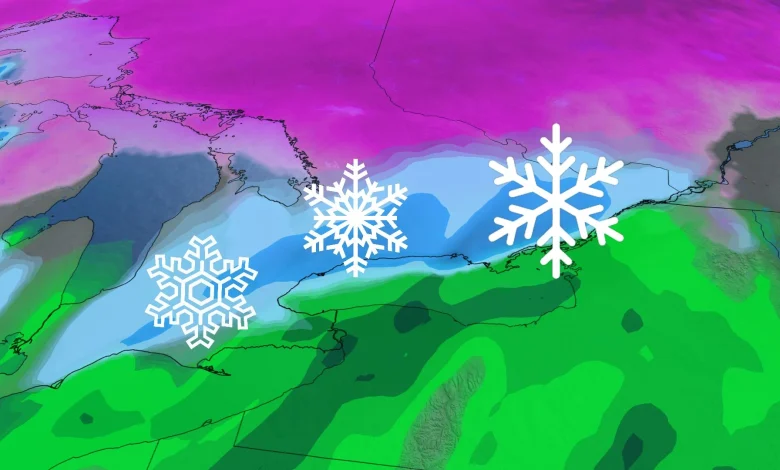
North of the storm track, areas like cottage country, Haliburton, and regions east of Lake Huron and Georgian Bay could see significant wet snowfall, with totals exceeding 10 cm. In contrast, areas near and south of the track, including parts of the Greater Toronto Area (GTA), may experience a mix of rain and snow or mainly rain.
The storm’s precise path remains uncertain, with the potential for significant impacts if it shifts south.
While it’s still the beginning of November, these early season snowfalls remind residents to prepare for shifting driving conditions and ensure vehicles are winter-ready. Residents are advised to monitor any developing weather alerts and to prepare for potentially slippery roads and reduced visibility in affected areas.
Sunday: Snow dependent on storm track and temperatures
A significant weather system on Sunday could bring widespread snowfall to southern Ontario, as Arctic air filters in behind the storm. The storm’s track will be critical in determining precipitation type and accumulation across the region.
If the system tracks southward, snowfall is possible near the 401 corridor, while a northern track could introduce rain or a rain-snow mix, particularly for areas like the GTA lakeshore, Niagara, and Ottawa where temperatures may hover slightly above 0°C.