Intense lake-effect snowstorm targets Great Lakes with up to 2-feet as Winter Storm Warning issued for Chicago
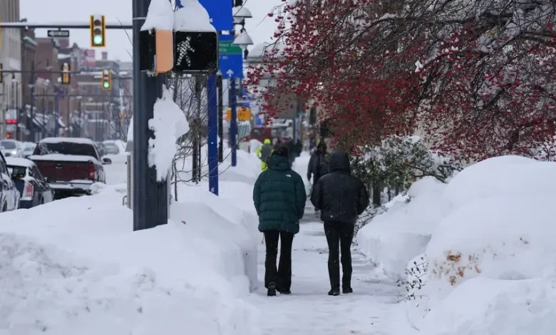
Chicago is under a Winter Storm Warning in November for the first time in seven years. The area around Lake Michigan is set to be blasted by several inches of snow, and in some places, over a foot. This heavy, blowing snow could cause travel headaches, especially at Chicago’s major airports.
The Great Lakes are bracing for the first snowfall of the season as heavy lake-effect snow makes its way to the region. Some areas could see 2 feet of snow with a ceiling up to even 4 feet of snow, bringing the first signs of what will be an impactful La Niña winter to come.
The National Weather Service has warned of “dangerous to impossible travel conditions due to intense lake-effect snow” that will cripple travel from greatly reduced visibility.
Winds could gust up to 30 mph with these heavy lake-effect snow conditions, especially near the Lake Michigan shoreline.
HOW LA NIÑA, POLAR VORTEX WINDS COULD FUEL A FAST-START TO BRUTAL WINTER FOR PARTS OF THE US
The National Weather Service has issued the first Winter Storm Warning in the month of November for Chicago in seven years, according to the FOX Forecast Center.
Snow estimations from Friday into Saturday.
(FOX Weather)
The National Weather Service team in Chicago also warned that this lake-effect snowstorm could become “a very dangerous and life-threatening situation beneath the most intense and stationary lake effect snow bands.”
A fast-moving area of low pressure which brought snow to the Dakotas on Saturday morning, is now moving toward the Great Lakes and the Northeast, according to the FOX Forecast Center.
For some parts of the Great Lakes and Northeast, this system could produce the first measurable snowfall of the season.
WHAT IS THE WINTER STORM WARNING CRITERIA?
By Sunday, the fast-moving low will be positioned across Central Illinois, allowing for moisture to continue to funnel into portions of the Midwest and Great Lakes. Cold air will continue to be drawn down from Canada, allowing for snow to occur.
Lake-effect snow blankets Ashtabula County, while heavy snow across the Great Lakes, bury parts of Erie, Pennsylvania, and Cassadaga and New York under feet of snow in Ohio, United States on December 03, 2024.
(Lokman Vural Elibol/Anadolu via Getty Images / Getty Images)
Northwest Indiana could see up to two feet of snow, while parts of Michigan and upstate New York are likely to see 8–12 inches with locally higher amounts possible.
HOW MUCH WILL IT SNOW ACROSS AMERICA? EARLY FLAKE OUTLOOK FOR BREWING LA NIÑA WINTER
Snow Forecast for Sunday through Tuesday.
(FOX Weather)
By Sunday night, the low pressure will continue to move east, allowing for more lake-effect snow to occur near Lake Michigan.
An intense band of snow is forecast to set up and continue overnight Sunday through Monday morning.
WHAT YOU SHOULD KNOW ABOUT BLOWING, DRIFTING SNOW
Great Lakes average first snow.
(FOX Weather)
The area of low pressure will move into the Northeast Monday into Tuesday, bringing snow downwind of lakes Erie and Ontario.
Areas just inland of the Great Lakes in upstate New York, Pennsylvania and Ohio are likely to see 8-12 inches of snow.
HOW TO WATCH FOX WEATHER
ERIE, PENNSYLVANIA, UNITED STATES – DECEMBER 2: An unforgiving lake-effect snow blankets the Great Lakes, disrupting daily life in New York and Pennsylvania, United States on December 02, 2024. (Photo by Lokman Vural Elibol/Anadolu via Getty Images)
(Getty Images)
Heavier snow bands will set up as the low pressure continues to move through and eventually out of the Northeast.
LIVE STORM TRACKER FOR LAKE-EFFECT SNOW OUTBREAK
Outside the snow, winds will be very gusty as this low continues to pivot through. Wind gusts up to 35–40 mph are possible, closer to the area of low pressure and the Great Lakes.