- Snow showers ending this evening with dry conditions ahead
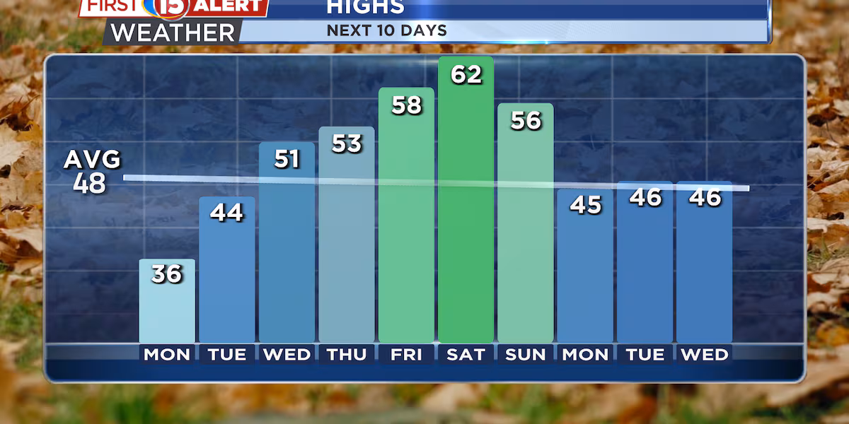
- Temperatures climbing from the 30s today to the 60s by next Saturday
- Rain is possible next weekend as warmer air arrives
MADISON, Wis. (WMTV) – After receiving .6″ at Dane County Regional Airport overnight, any additional snow showers will taper off this evening as we head into a quieter weather pattern for the new work week. Today’s cold temperatures in the 30s will persist through Monday, followed by a gradual warming trend.
The scattered snow showers moving through this afternoon will come to an end after sunset. These brief bursts of snow may drop visibility quickly, so use extra caution if you’re driving during any of these passing showers. Winds will remain gusty through this evening before calming down overnight.
Monday will bring another cold day with highs struggling to get out of the upper 30s. The good news is that winds won’t be as strong, making it feel less harsh than today’s conditions.
What’s Coming Up…
A significant warmup begins Tuesday and continues through the week. Temperatures will return to normal levels by Wednesday, with highs climbing into the 50s. The warming trend accelerates toward the weekend, with Saturday potentially reaching the lower 60s across southern Wisconsin.
The dry weather pattern continues through most of the week as high pressure builds over the region. This ridge of high pressure will keep any storm systems to our north, ensuring pleasant conditions for outdoor activities.
Looking Ahead…
Looking ahead to next weekend, our first chance for rain in over a week arrives Saturday and Sunday. A weather system moving in from the west will bring scattered showers, but temperatures will remain mild with highs in the 60s.
Click here to download the WMTV15 News app or our WMTV15 First Alert weather app.
Copyright 2022 WMTV. All rights reserved.