- NEXT 12 HOURS: Snow showers taper off, cold night
- SHORT TERM: Breezy, staying chilly starting the work week
- LONG TERM: Turning milder, wet weather next weekend
WAUSAU, Wis. (WSAW) – Some slippery travel possible through Sunday night where snow showers are impacting the region. The warmer coat will be good to have on again for Monday. Temperatures will rebound to near or above average later in the week, while the next weather maker arrives during the weekend.
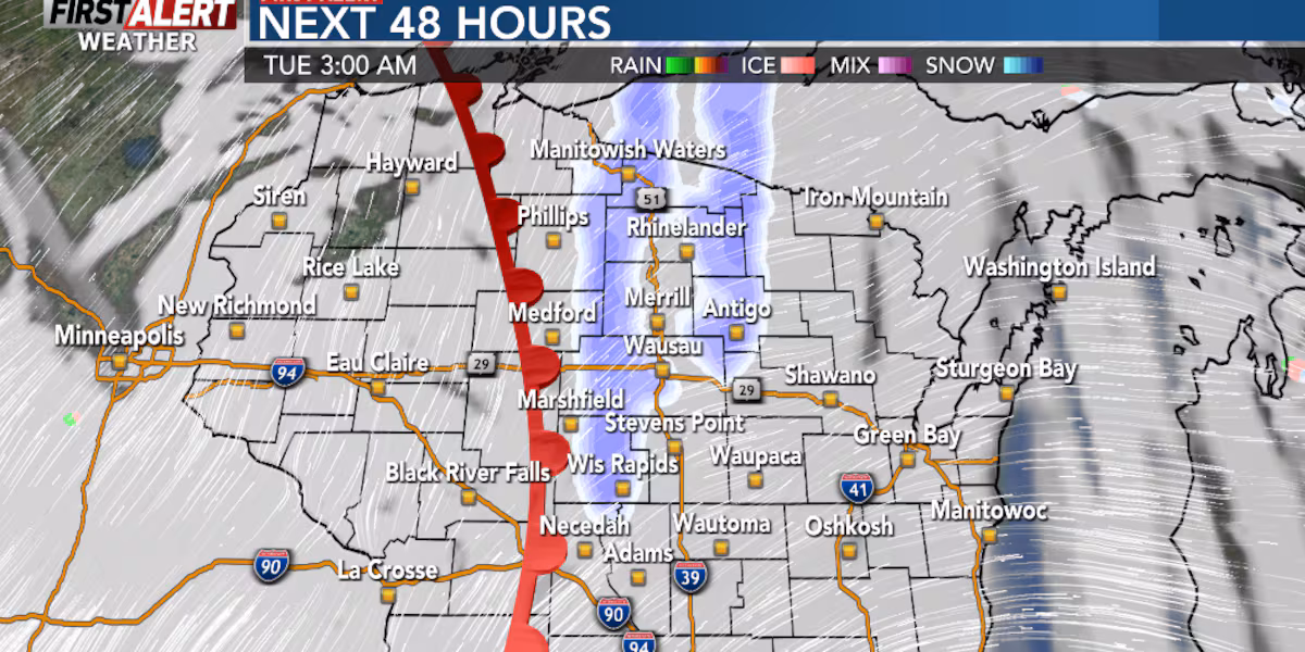
Snow showers will taper off Sunday evening in most of the area, while lake effect snow showers continue in the far north. Partly to mostly cloudy Sunday night and cold, with lows by daybreak on Monday in the upper 10s to around 20.
Snow showers taper off with some clouds overnight and cold(WSAW)
What’s coming up
Clouds with some breaks of sun on Monday, breezy, and chilly. Highs in the low to mid 30s. A warm front will push across the area late Monday night into early Tuesday morning, with a few snow showers. A First Alert for a few slick spots on the roads during the early commute on Tuesday morning. Clouds breaking for some sun on Tuesday, still breezy. Highs in the low 40s.
Chilly with a few clouds Monday night at the Packers game(WSAW)
Looking ahead
Partly cloudy and milder conditions on tap for the remainder of the work week. Still breezy on Wednesday, with highs in the low to mid 40s. Temperatures will climb into the mid 40s Thursday, and upper 40s for a high on Friday.
The next weather maker could affect the region next weekend, with scattered showers on Saturday, while rain is possible on Sunday. Still on the mild side, with highs in the upper 40s to low 50s.
The First Alert Weather 7 Day Forecast(WSAW)
Click here to download the WSAW News app or our WSAW First Alert weather app.
Copyright 2025 WSAW. All rights reserved.