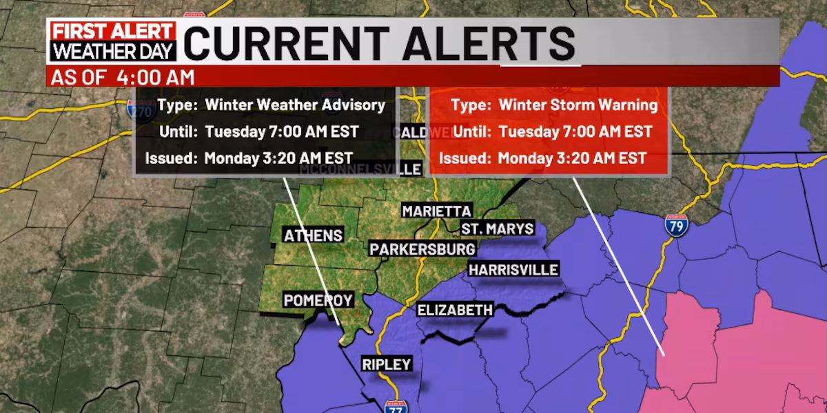
PARKERSBURG, W.Va. (WTAP) – It is feeling like we are already in December as our first snowfall of the season arrives in the Mid-Ohio Valley. Winter weather advisories have been expanded this morning to include Jackson, Wirt, and Ritchie counties through the day on Monday. Areas within the advisory could see snow accumulation of above an inch with spots up to 3 inches. Those outside the advisory will still see snow accumulation, but that is expected to stay under an inch.
The first snow of the season is here across the Mid-Ohio Valley.
Slick spots are going to be likely as we see snow falling through the morning commute. Snow showers are expected to be around through the afternoon and then move out by the evening. The slick spots will have a better chance of developing on bridges and overpasses through the day. It is going to be less likely on our main roads. Overall, take your time getting to work or school this morning as well as for on the way home.
Our weather will improve over the next several days. We will also get to see an increase in temperatures. Tuesday will still be chilly with daytime highs into the upper 30s. We will then get a noticeable warm up on Wednesday as we return to the mid-50s. However, it will be breezy with gusts up to 20 mph across Tuesday and Wednesday. This will continue make those days feel extra cold.
The rest of the week will stay dry. Expect sunshine with some clouds through the day on Wednesday and through Friday. Showers chances are not expected to return to the Mid-Ohio Valley until the next upcoming weekend. And do not worry, there is no frigid weather or snow in the forecast for the next several days.
Copyright 2025 WTAP. All rights reserved.